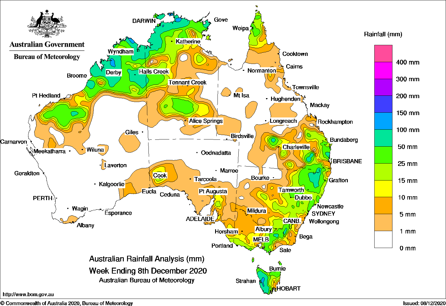
THUNDERSTORMS generated moderate falls across the northern tropics, south-east Queensland and north-east New South Wales, while a cold front produced moderate falls in south-east Australia.
Past seven days: In the first part of the week, a cold front crossed Tasmania and brought moderate falls to the west of that state. A surface trough extended across the Kimberley, the Northern Territory, and from north-west Queensland to north-eastern New South Wales. Thunderstorms and showers produced moderate falls across parts of the Kimberley in Western Australia, the Top End of the Northern Territory, and the Cape York Peninsula. Thunderstorms also developed over parts of the central east coast and north-eastern New South Wales, and in parts of southern and south-east inland districts of Queensland, generating moderate falls in those areas.
By the middle of the week, surface troughs also extended down through the north-west of Western Australia, and triggered thunderstorms over the Pilbara and Kimberley districts. Thunderstorms and showers continued across the Top End in the Northern Territory.
In the last part of the week, a cold front tracked across south-east Australia, and brought widespread light falls to south-east South Australia, Victoria, most of New South Wales and Tasmania. Moderate falls were reported in north-eastern Victoria, large parts of central to eastern New South Wales, and northern and western Tasmania.
In the north, a surface trough extended from the Pilbara coast in Western Australia, through the southern Northern Territory and to the south-east of Queensland. Widespread thunderstorms developed near the trough and brought moderate falls to the Kimberley, north-west and central parts of the Northern Territory and then across south-east Queensland at the end of the week.
Rainfall totals in excess of 100 mm were reported in spots of the Kimberley in Western Australia, pockets of the Top End in the Northern Territory, parts of south-east Queensland and north-eastern New South Wales, and an area of western Tasmania. The highest weekly total was 184 mm at Kings Plains (Windermere) in New South Wales.
Rainfall totals in excess of 50 mm were reported in pockets of northern Western Australia, in the north-west and northern coast of the Northern Territory, pockets of south-east Queensland, areas of north-east New South Wales, and western Tasmania.
Rainfall totals between 10 mm and 50 mm were reported across most of northern Western Australia, the Top End and in western and southern parts of the Northern Territory, in the far north and southern parts of Queensland, most of central to eastern New South Wales, southern and north-eastern Victoria, most of Tasmania and small parts of southern South Australia.
Highest weekly totals
New South Wales and Australian Capital Territory
184 mm Kings Plains (Windermere)
112 mm Glen Innes Airport AWS
103 mm Bukkulla (RFS)
Victoria
86 mm Falls Creek
67 mm Wilsons Promontory Lighthouse
46 mm Monbulk (Spring Road)
Queensland
125 mm Traighli
100 mm Kenilworth Township
95 mm The Deep Crossing
Western Australia
156 mm Cygnet Bay
116 mm Mount Hart Station
113 mm Derby Aero
South Australia
24 mm Brinkworth (Bungaree)
23 mm Brinkworth
22 mm Snowtown (Rayville Park)
Tasmania
137 mm Mount Read
110 mm Queenstown (South Queenstown)
97 mm Strathgordon Village
Northern Territory
160 mm Middle Point
147 mm Murganella Airstrip
117 mm Labelle Downs
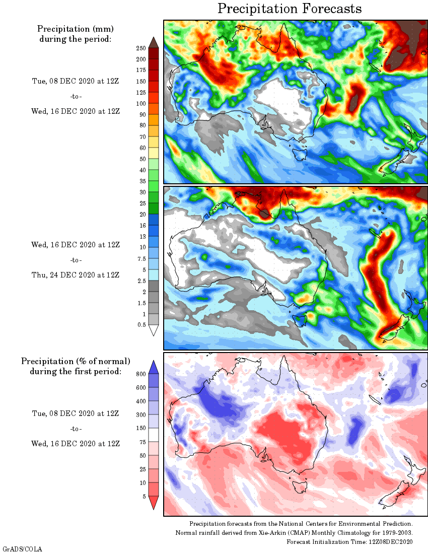
Rainfall outlook
HAVE YOUR SAY