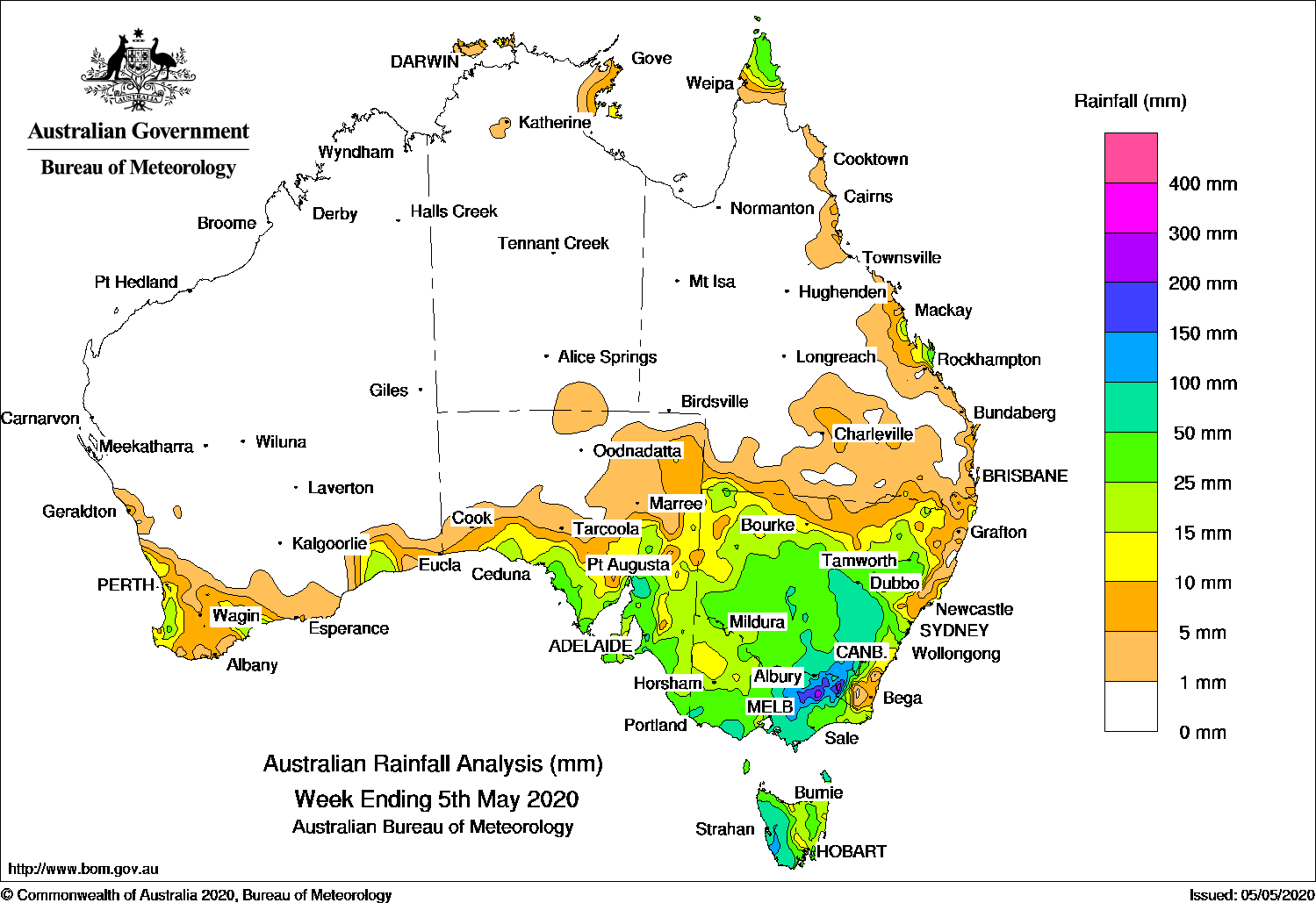
Past seven days: Easterly onshore flow produced some showers and moderate rainfall in the northern Cape York Peninsula and east coast Queensland and the eastern Top End in the northern Territory during the first half of the week.
In the first part of the week, a cloud band associated with a surface trough extended from Central Australia into New South Wales, Victoria, and Tasmania. In the meantime, a cold front connected to a low pressure system south of the Great Australian Bight tracked across southern Australia, interacting with the trough as it crossed the south-east. Widespread moderate to locally heavy rainfall resulted in central to eastern Victoria, New South Wales except the north-east, and across Tasmania. Light to moderate rainfall was reported in south coast Western Australia, southern and eastern South Australia, and remaining parts of Victoria.
By the middle of the week, the low pressure system had intensified into a complex low as it moved slowly across Tasmania to the Tasman Sea. A persistent unstable and cold south-westerly air stream with a series of embedded cold fronts and troughs followed over the south-east during the remainder of the week. These produced persistent light to moderate rainfall over south-eastern South Australia, southern and eastern Victoria, southern and central New South Wales west of the ranges, and Tasmania. Heavy snow was reported in Alpine regions, with light snowfall also sighted in the south-east at some elevated locations.
Moist onshore flow produced showers and moderate falls along the north tropical coast of Queensland throughout the week, with heavier showers developing.
Rainfall totals in excess of 50 mm were recorded in western Tasmania, small areas in the Manning district in New South Wales, and about the north tropical coast of Queensland. The highest weekly total was 145 mm at Mount Read in Tasmania.
Rainfall totals in excess of 25 mm were recorded in parts of southern and south-eastern South Australia, through central western to north-eastern Victoria, elevated areas of the Snowy Mountains in New South Wales, parts of the north tropical coast of Queensland, and western and northern Tasmania.
Rainfall totals between 10 mm and 25 mm were recorded in parts of the south-west coast of Western Australia, in southern South Australia, most of Victoria except the southwest, parts of southern and north coast New South Wales, and the north tropical Queensland coast between Cooktown and Ingham.
In the west, a cold front moved through the south-west of Western Australia and produced light to moderate rainfall to the South West Land Division towards the end of the week.
Rainfall totals in excess of 50 mm were recorded across the eastern half of Victoria except East Gippsland, west of the ranges in inland south and central New South Wales, western Tasmania, and some pockets of coastal South Australia, Falls of 100 mm or higher were observed in across north-eastern Victoria and the Snowy Mountains in New South Wales, mostly on the inland side of the ranges. The highest weekly total was 262 mm at Whitlands, to the south of Wangaratta, in Victoria.
Rainfall totals between 10 mm and 50 mm were recorded in parts of south-west and south coast Western Australia, in southern and eastern South Australia, and across most remaining parts of Victoria, Tasmania, and New South Wales except parts of the northern border, north coast, and far south-east coast. Weekly totals in excess of 10 mm were also observed about the northern tip of Cape York Peninsula, and east coast Queensland between Mackay and Rockhampton.
Highest weekly totals
New South Wales and Australian Capital Territory
205 mm Thredbo Village
180 mm Thredbo Aws
177 mm Perisher Valley Aws
Victoria
262 mm Whitlands (Burder’S Lane)
200 mm Falls Creek
195 mm Hunters Hill
Queensland
70 mm Fraser Island Eurong
66 mm Lockhart River Airport
63 mm Pacific Heights
Western Australia
40 mm Capel North
36 mm Thomson Brook
35 mm Perivale OrchardRavenscliffe Alert
South Australia
114 mm Wirrabara Forest
89 mm Melrose
85 mm Mannanarie
Tasmania
132 mm Mount Read
127 mm Scotts Peak Dam
110 mm Lake Margaret Power Station
Northern Territory
15 mm Groote Eylandt Airport
14 mm Black Point
7 mm Gove Airport
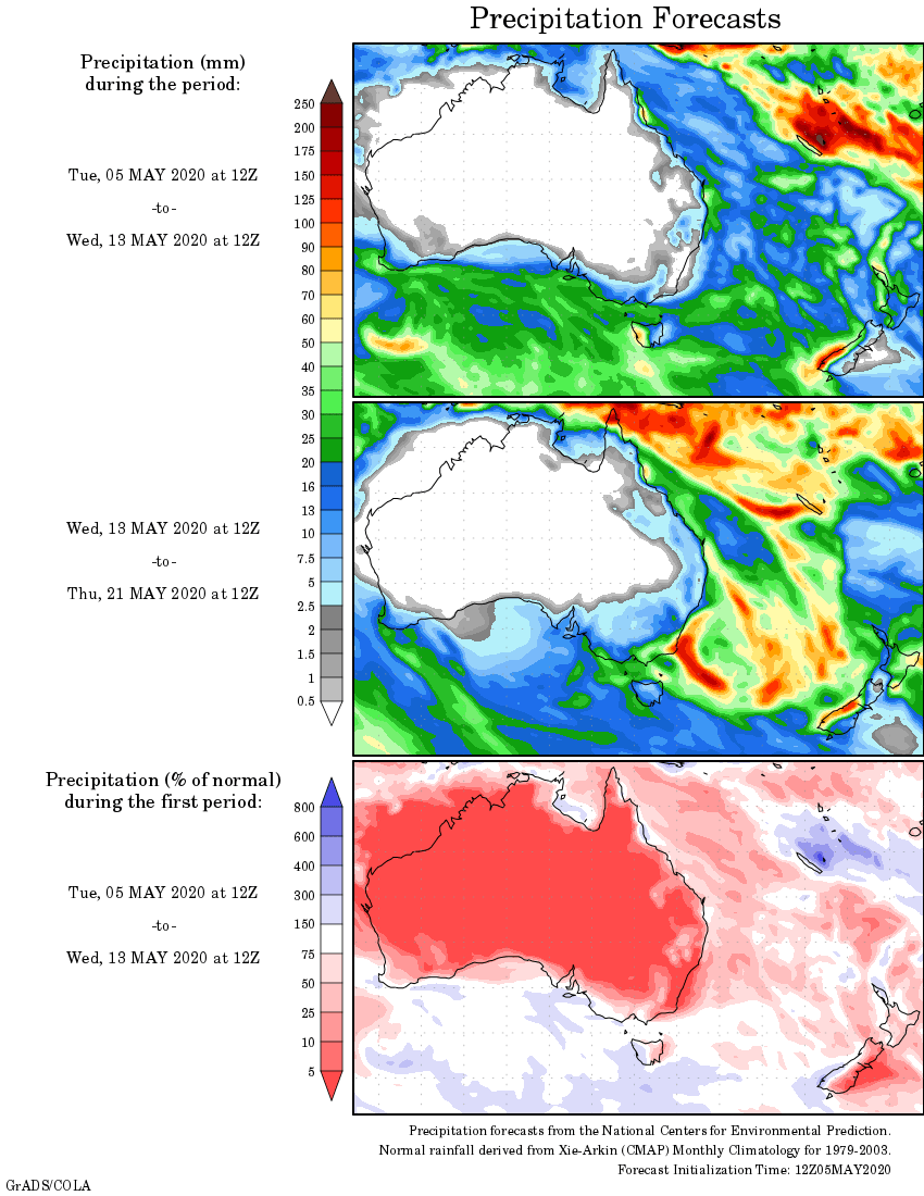
Rainfall outlook
HAVE YOUR SAY