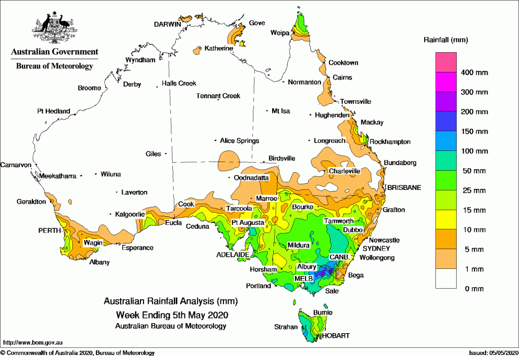
Past seven days: At the start of the week, moist onshore flow produced showers along parts of the New South Wales and Queensland coast.
In the first part of the week, a strong cold front attached to a complex low tracked across southwest Western Australia, generating strong winds and widespread moderate falls across much of the South West Land Division. The cold front tracked eastwards, and produced light falls in parts of southern South Australia and Tasmania. A second cold front soon followed and moved across southwest Western Australia and southern South Australia. Moderate falls were recorded in far southwest Western Australia, southern South Australia, western Victoria, and Tasmania.
From mid-week, the cold front moved across Victoria, Tasmania and southern New South Wales, with a pre-frontal trough extending from Central Australia to the southeast, and a trough developed near the northeast coast of New South Wales. The systems produced moderate rainfall in southern central and northeastern parts of Victoria, western Tasmania, and through inland southeastern and northeastern New South Wales, with widespread light falls across the southeast.
At the end of the week, a westerly flow with an embedded cold front tracked across the eastern Bight, bringing mainly light rainfall to western Tasmania.
Moist onshore flow produced showers and moderate falls in the eastern Arnhem District of the Northern Territory, and along the north tropical coast of Queensland during the week.
Rainfall totals in excess of 50 mm were recorded in parts of the southwest coast of Western Australia, western Tasmania, the north tropical Queensland coast, and isolated areas of northeast New South Wales. The highest weekly total was 157 mm at Mount Read in Tasmania.
Rainfall totals in excess of 25 mm were recorded in parts of southwest Western Australia, coastal southeastern South Australia, parts of southern coastal Victoria and elevated areas of the Victorian Alps, western Tasmania, small areas of southeastern and northeastern New South Wales, and the north tropical coast of Queensland.
Rainfall totals between 10 mm and 25 mm were recorded across much of the South West Land Division in Western Australia, southern South Australia, Tasmania, most of southern to northeastern Victoria, northeastern and inland southeastern New South Wales, and along parts of Queensland’s east coast.
Highest weekly totals
New South Wales and Australian Capital Territory
85 mm Ballina Airport AWS
70 mm Mullumbimby (Fairview Farm)
48 mm Perisher Valley AWS
Victoria
46 mm Balook
45 mm Wilsons Promontory Lighthouse
40 mm Mount BullerPound Creek
Queensland
71 mm Tully Sugar Mill
68 mm Innisfail
65 mm Cowley Beach (Defence), Greenhaven
Western Australia
97 mm Denmark
70 mm Albany
69 mm Barrett Meadows
South Australia
53 mm Uraidla
47 mm Aldgate, Heathfield Works Depot
Tasmania
157 mm Mount Read
139 mm Lake Margaret Dam
103 mm Queenstown (South Queenstown)
Northern Territory
20 mm Groote Eylandt Airport
14 mm Mccluer Island
3 mm Ngayawili Murganella Airstrip
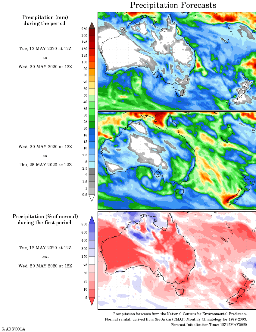
Rainfall outlook


HAVE YOUR SAY