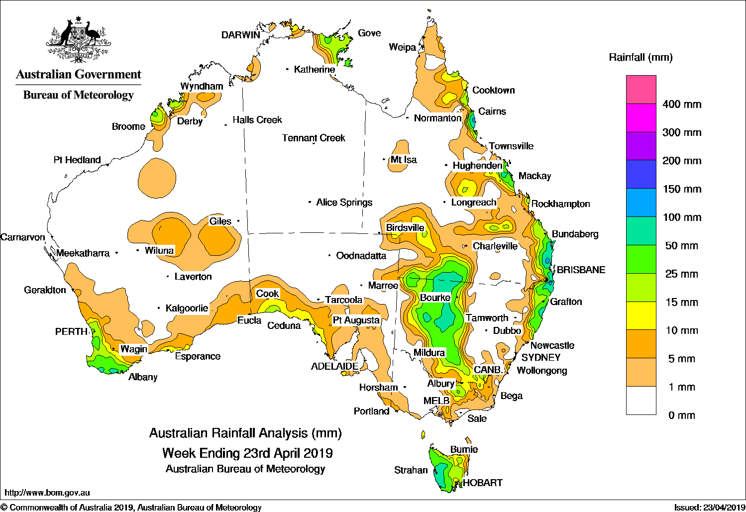
Onshore flow, and an upper level low and surface trough brought moderate falls to parts of eastern Australia.
Past seven days: At the start of the week, onshore flow and surface troughs produced showers and light to moderate falls in Queensland’s north tropical and south-east coasts, into north-eastern New South Wales. A cold front tracked across south-east Australia, with embedded thunderstorms in a vigorous westerly flow producing moderate falls in western Tasmania. Another strong cold front crossed south-west Western Australia, bringing gusty winds and moderate falls to the south-west and parts of the southern coast of that State. A pre-frontal trough triggered isolated thunderstorms through parts of the interior districts of Western Australia, while showers developed along a broad surface trough over the west Kimberley coast.
By the middle of the week, the second cold front tracked across southern parts of South Australia, with a pool of cold and unstable air with isolated thunderstorms behind the front generating moderate falls in the South West Coast and Eyre Peninsula districts. A high pressure ridge along the east coast of Australia produced onshore showers, generating moderate falls in Queensland’s north tropical and south-east coasts, and north-eastern New South Wales.
In the second half of the week, the cold front had tracked across south-eastern Australia, with a surface trough stretching north through western Queensland. Light falls were reported in eastern South Australia, central to north-eastern Victoria, and Tasmania. An upper level low and the associated trough through western Queensland generated a cloud band that extended through the eastern interior of Australia.
Embedded thunderstorms produced moderate falls in western to central New South Wales, and parts of south-west Queensland, extending into areas of central Queensland. Onshore winds continued to generate showers and moderate falls along the Queensland and New South Wales coasts to the end of the week.
Isolated thunderstorms and showers produced light to moderate falls across much of Arnhem Land in the Northern Territory throughout the week.
Rainfall totals in excess of 100 mm were recorded in the north tropical and southeast Queensland coasts, and north-eastern New South Wales. The highest weekly total was 177 mm at Bingil Bay, located in the north tropical coast of Queensland.
Rainfall totals in excess of 50 mm were recorded in the far southwest of Western Australia; western Tasmania; in the north-east and north-west of New South Wales, and about the south-west interior, southeast, central, and north tropical coasts of Queensland.
Rainfall totals between 10 mm and 50 mm were recorded in the western Kimberley, southwest and parts of the southern coast of Western Australia; areas of Arnhem Land in the Northern Territory; the south-west coast of South Australia; most of Tasmania; northeastern Victoria and much of western and north-eastern New South Wales.
Little or no rainfall was recorded in remaining parts of Western Australia, the Northern Territory and South Australia; the western half and parts of south-eastern Victoria; the central interior to central coast of New South Wales; the south-eastern interior, and much of central to western Queensland.
Highest weekly totals
New South Wales and Australian Capital Territory
140 mm Boat Harbour (Rous River)
98 mm Eungella (Oxley River)
95 mm Uki (Tweed River)
Victoria
25 mm Milawa, Brown Bros
19 mm Jindivick
18 mm Dederang, Eurobin
Queensland
177 mm Bingil Bay
164 mm Springbrook Road
125 mm Peachester
Western Australia
50 mm Shannon
47 mm Denbarker
46 mm Northcliffe
South Australia
20 mm Nullarbor
16 mm Flinders Chase (Rocky River), Streaky Bay
Tasmania
74 mm Lake Margaret Power Station
68 mm Mount Read, Queenstown (South Queenstown)
Northern Territory
58 mm Ngayawili
40 mm Wave Hill
39 mm Groote Eylandt Airport
Source: BOM
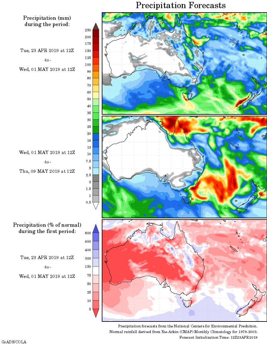
Rainfall outlook:
HAVE YOUR SAY