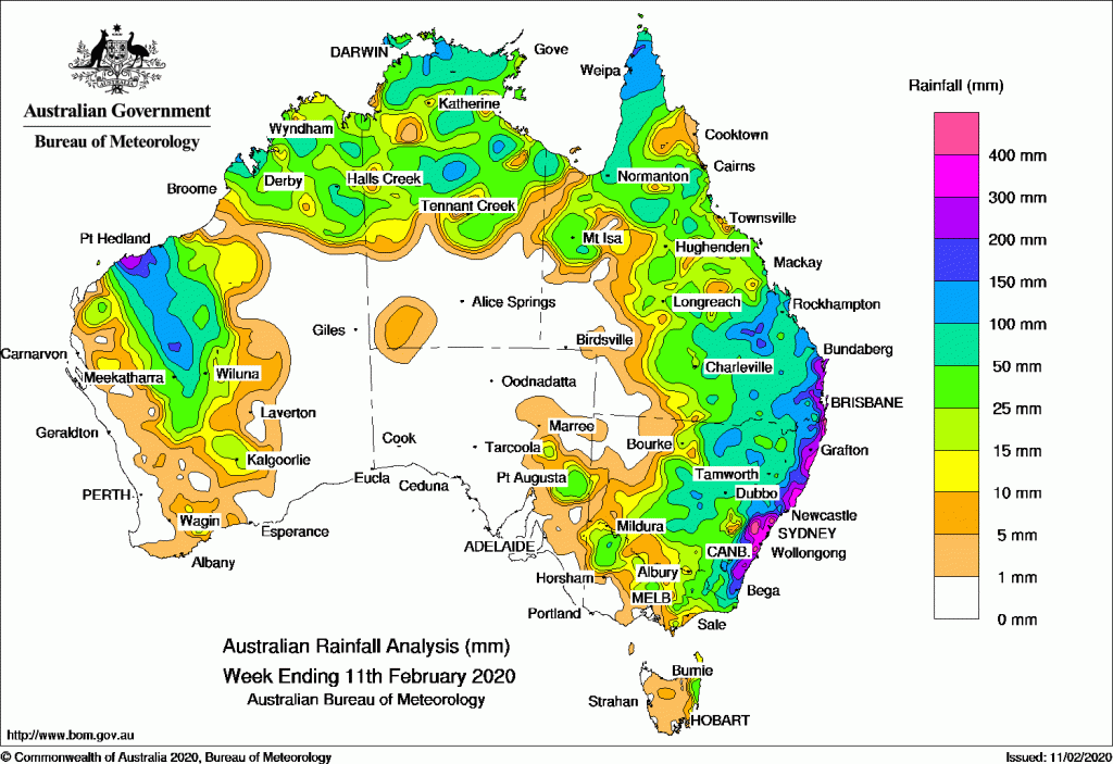
Past seven days: At the start of the week, a tropical low pressure system was located near the coast of the western Kimberley district of Western Australia. A weak monsoon trough extended across Cape York Peninsula and the Gulf of Carpentaria and over the Top End, with showers and thunderstorms across the far north. A trough positioned across inland Queensland and New South Wales produced isolated storms.
In the first half of the week, tropical cyclone Damien developed offshore north of Port Headland, in northwest Western Australia, and continued to move south-west intensifying to a severe tropical cyclone. Across northern Australia a chain of thunderstorms, associated with the monsoon trough, extended towards the northern Coral Sea, while an influx of moist air from the Coral Sea produced a showers and storms which extended from northern Queensland through to Victoria. A slow-moving coastal trough over the south-east of Queensland and northern New South Wales resulted in showers, extensive areas of rain and heavy falls.
In the second half of the week, tropical cyclone Damien started to move towards the coast; it made landfall near Dampier as a category 3 system, then weakened to tropical low while moving through inland Pilbara and central Western Australia producing heavy rain. A weak monsoon though across central parts of the Northern Territory and northern Queensland produced scattered showers and isolated thunderstorms. A coastal trough positioned parallel to the east Australian coast strengthened, maintaining widespread showers and rain areas across south-eastern Queensland and eastern New South Wales, before moving south and weakening.
Rainfall totals in excess of 200 mm were recorded in south-east Queensland, in eastern New South Wales, and around Port Headland in north-west Western Australia.
Rainfall totals in excess of 100 mm were recorded in the northern part of Cape York Peninsula, and southeast Queensland, most of eastern New South Wales, in isolated areas across the Top End in the Northern Territory, and in parts of Pilbara, West Gascoyne and in isolated pockets in the north of Western Australia.
Rainfall totals in excess of 50 mm were recorded in areas surrounding higher falls, and in the northeast of Victoria.
Rainfall totals between 10 and 50 mm were recorded in East Gascoyne, Central and parts of south-east and south coastal districts and areas in the north of Western Australia, in south-east South Australia, parts of the Northern Territory, large areas mostly in north-eastern and central Queensland, parts of central New South Wales, most of northern Victoria, and eastern Tasmania.
Highest weekly totals
New South Wales and Australian Capital Territory
704 mm Robertson
633 mm Tweed Heads
612 mm Wattamolla (Griffiths)
Victoria
63 mm Bronzewing
61 mm Balook
59 mm Falls Creek
Queensland
434 mm Coolangatta
403 mm Tin Can Bay
Western Australia
235 mm Karratha Aero, Roebourne Aero
215 mm Cygnet Bay
South Australia
50 mm Manna Hill
48 mm Oodla Wirra (Mccoys Well)
33 mm Yunta Airstrip
Tasmania
85 mm Gray
48 mm Pyengana
47 mm St Helens Aero
Northern Territory
149 mm Labelle Downs
136 mm Hayward Creek (Tipperary)
117 mm Elliott
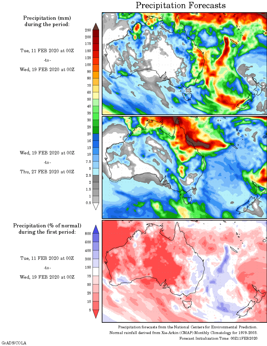
Rainfall outlook


HAVE YOUR SAY