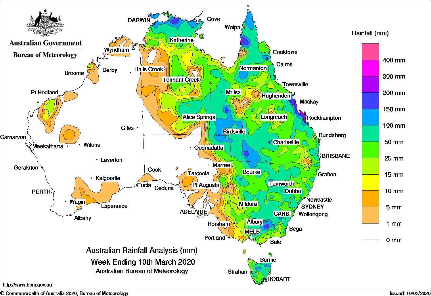
LOW pressure systems brought moderate to heavy falls of rain across New South Wales, Victoria and Tasmania over the past week.
Past seven days: In the first part of week, ex-tropical cyclone Esther moved east south-east across the Northern Territory, south-west Queensland and northern New South Wales.
A deepening surface trough extended from the Northern Territory, through the remnants of Esther, inland eastern mainland and south through Tasmania. An embedded low pressure system developed in central Victoria. Moderate to heavy rainfall was recorded in central to south-eastern parts of the Northern Territory, in western and south-western Queensland, and parts of western New South Wales. Moderate falls were also recorded in far north-eastern South Australia.
The slow-moving surface trough and embedded lows interacted with an upper level disturbance, producing further widespread moderate to locally heavy falls of rain across most of Queensland, New South Wales, Victoria and Tasmania until the middle of the week. A surface trough across northern Western Australia also brought moderate falls to parts of the Pilbara, and isolated showers in central and southern parts of that State.
Around the middle of the week, onshore flow produced showers along most the east coast of Queensland and New South Wales, while showers and thunderstorms developed over the north-east Top End.
In the last part of the week, a surface trough was located from north-west to southern Queensland, into western New South Wales. Showers and thunderstorms developed east of the trough, with moderate falls over much of northern, central and southern Queensland, as well as along that state’s east coast. Another trough extended across northern Australia and monsoonal flow developed to the north of Australia. Moderate falls were also recorded in the northern Top End of the Northern Territory.
Rainfall totals in excess of 200 mm were recorded in parts of the central coast of Queensland, including the highest weekly total of 428 mm at Samuel Hill Aero.
Rainfall totals in excess of 100 mm were recorded in the northern Top End of the Northern Territory; parts of the Cape York Peninsula, central and Capricornia coasts, and south-west Queensland; far north-eastern South Australia; pockets of central New South Wales; elevated areas of north-eastern Victoria, and parts of northern Tasmania.
Rainfall totals in excess of 50 mm were recorded in the northern Top End and central to south-eastern parts of the Northern Territory; western, southern inland, northern, and along the east coast of Queensland; across northern, central, southern and south-eastern parts of New South Wales; central to north-eastern Victoria, and much of northern Tasmania.
Rainfall totals between 10 mm and 50 mm were recorded in parts of the Pilbara coast of Western Australia, most of northern and eastern parts of the Northern Territory, most of Queensland, New South Wales, Victoria, Tasmania, and far eastern parts of South Australia.
Little to no rainfall was recorded in most of Western Australia, far southern parts of the Northern Territory, and South Australia away from that State’s far east.
Highest weekly totals
New South Wales and Australian Capital Territory
240 mm Kempsey Airport AWS
137 mm Brewarrina Hospital
135 mm Fowlers Gap AWS
Victoria
171 mm Dederang
159 mm Falls Creek (Rocky Valley)
153 mm Falls Creek
Queensland
428 mm Samuel Hill Aero
379 mm Brampton Vale
331 mm Yeppoon, The Esplanade
Western Australia
41 mm Mardie
18 mm Pannawonica, Country DownsYalleen
South Australia
39 mm Moomba Airport
24 mm Meribah (Merallen)
23 mm Paruna
Tasmania
185 mm Gray (Dalmayne Rd)
159 mm Mount Arthur Summit
144 mm Mount Barrow (South Barrow)
Northern Territory
253 mm Charles Darwin University
216 mm Leanyer
198 mm Darwin Airport
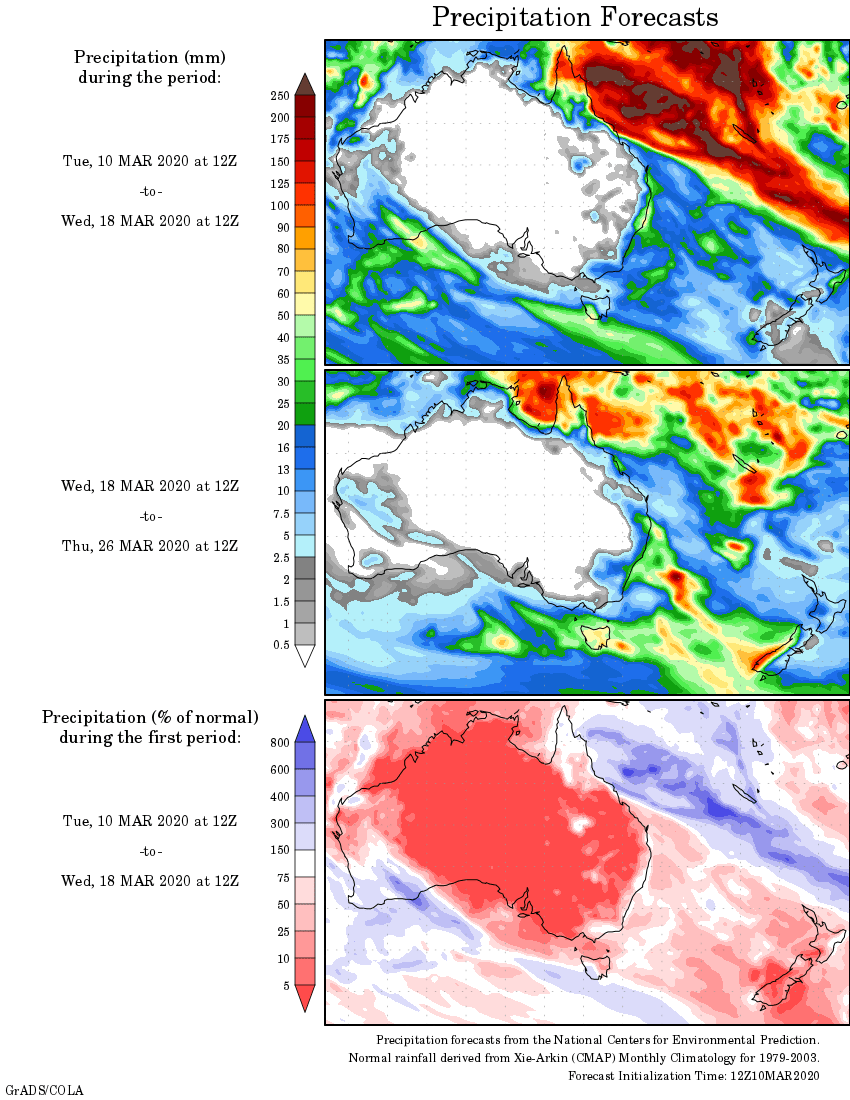
Rainfall outlook
HAVE YOUR SAY