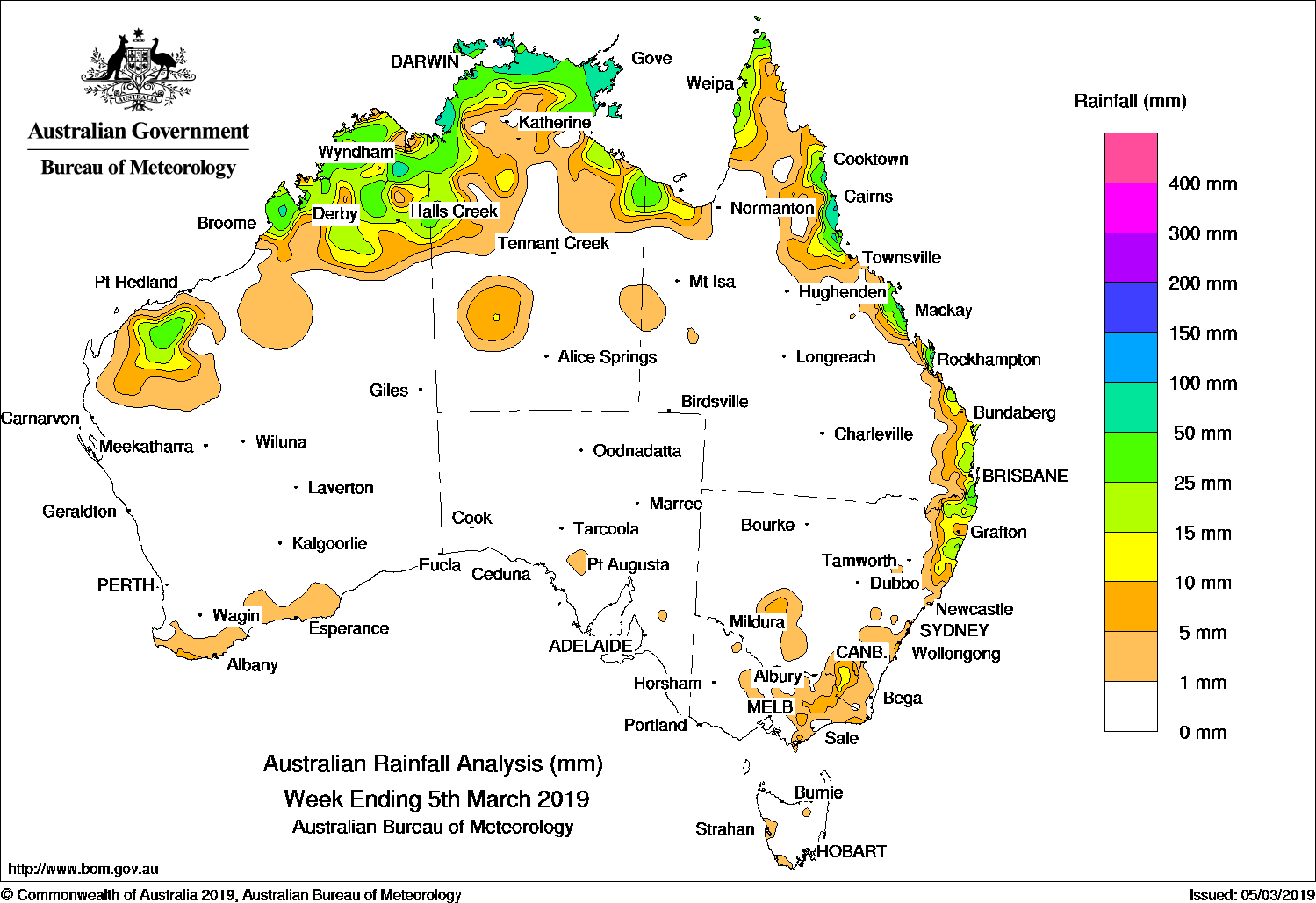
THUNDERSTORMS and showers developed along broad areas of low pressure across northern Australia, while an onshore flow and associated showers generated moderate falls along the Queensland and New South Wales east coast.
Past seven days: At the start of the week, broad areas of low pressure extended across northern Australia, with showers and storms generating isolated, moderate falls in the Kimberley in Western Australia, the Top End and Gulf Country in the Northern Territory, and the tip of Cape York Peninsula in Queensland. A strengthening high pressure system in the Tasman Sea extended a ridge along the east coast, resulting in a moist, onshore flow that produced light to moderate falls about the north tropical and central coasts of Queensland.
By the middle of the week, the high pressure system moved slowly east, maintaining a firm ridge along the east coast, and extending the onshore flow and associated showers further south to parts of the north-east coast of New South Wales. Onshore flow continued for the remainder of the week, and produced light to moderate falls along much of the east coast of Queensland.
In the last part of the week, thunderstorms and showers continued over the Kimberley and northern Top End, with isolated storms developing in parts of the Pilbara in Western Australia, and in central parts of the Northern Territory.
At the end of the week a cold front and pre-frontal trough tracked slowly across southern Australia and produced isolated, light falls along the south coast of Western Australia, eastern Victoria, and south-east New South Wales. While there were isolated heavier falls in eastern Victoria, dry lightning also sparked numerous fires across the east of the State.
Rainfall totals in excess of 50 mm were recorded in a small area of the Kimberley coast in Western Australia, coastal areas of the Top End in the Northern Territory, and the north tropical coast of Queensland. Isolated falls in excess of 100 mm were recorded in small areas of the Darwin – Daly District and Arnhem Land in the Northern Territory, and a small area of the north tropical Queensland coast. The highest weekly rainfall totals was 135 mm at Groote Eylandt Airport in the Northern Territory.
Rainfall totals between 10 mm and 50 mm were recorded in the western Pilbara and most of the Kimberley in Western Australia, coastal parts of the Top End and adjacent inland districts, parts of the Gulf Country and the west coast of Cape York Peninsula, along the east coast of Queensland south of Cooktown, extending along the north-east coast of New South Wales. Totals in excess of 10 mm were also recorded in a small area in the south-east of New South Wales, while light falls were recorded in eastern Victoria and the south coast of Western Australia.
Little or no rainfall was recorded in remaining parts of Western Australia and the Northern Territory, South Australia, most of Queensland away from the north and east coasts, most of New South Wales except in the north-east, the western half of Victoria, and Tasmania.
Highest weekly totals
New South Wales and Australian Capital Territory
54 mm Boat Harbour (Rous River)
44 mm Murwillumbah (Bray Park)
43 mm North MurwillumbahBowra Sugarloaf
Victoria
26 mm Snowy River
24 mm Murderers Hill
19 mm Point Hicks (Lighthouse)
Queensland
125 mm South Johnstone Exp Stn
116 mm Tully Sugar Mill
111 mm Mt Sophia
Western Australia
67 mm El Questro
64 mm Kilto Station
46 mm Drysdale River Station
South Australia
3 mm Cromer Road, Bower
2 mm Brownhill Creek, Mintaro (Mount Horrocks)
Tasmania
4 mm Maatsuyker Island Lighthouse
3 mm Cape Sorell, Corra Linn (North Esk River), Nunamara Offtake
Northern Territory
135 mm Groote Eylandt Airport
129 mm Maningrida Airport
104 mm Port Keats Airport
More weekly rainfall totals:
- NSW/ACT totals click here
- Vic totals click here
- Qld totals click here
- WA totals click here
- SA totals click here
- Tas totals click here
- NT totals click here
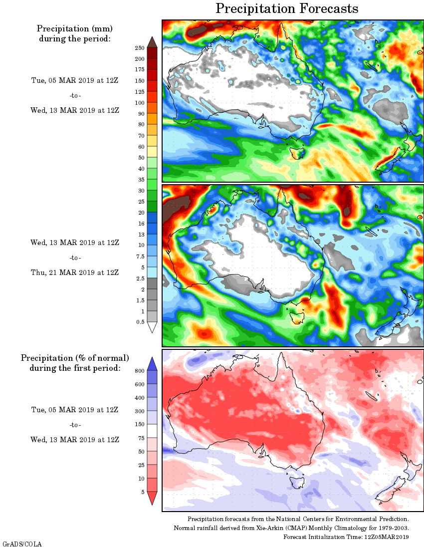
Rainfall outlook:
HAVE YOUR SAY