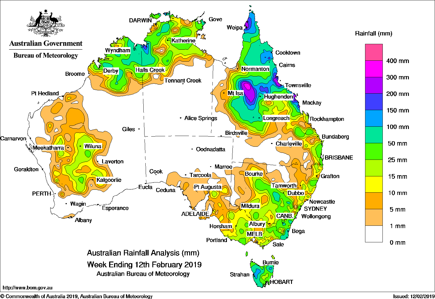
A COLD front and pre-frontal trough brought light falls to southern Victoria, and moderate falls in western Tasmania. Thunderstorms and showers produced light to moderate falls across northern Australia throughout the week.
Past seven days: At the start of the week, a cold front and pre-frontal trough tracked across southeast Australia and brought light to moderate falls to southern parts of Victoria, and western Tasmania. Light falls continued in western Tasmania into the middle of the week, associated with westerly flow.
Showers and isolated thunderstorms developed over the northeast of the Northern Territory and the Kimberley in Western Australia, while a surface trough along the east coast of Queensland triggered showers and thunderstorms, with moderate falls in southeast Queensland. As the week progressed, surface troughs extended along the west coast of Western Australia and across northern Australia, with another trough located through inland Queensland and New South Wales. These areas of low pressure generated isolated thunderstorms in parts of northern Western Australia, the north of the Northern Territory, and northern and eastern Queensland.
From the middle of the week, showers and thunderstorms developed across much of northern Australia, and along a surface trough that extended through central Queensland. The surface trough across northern Australia persisted until the end of the week, and brought moderate falls to the Kimberly in Western Australia, much of the north of the Northern Territory, and northern Queensland.
Rainfall totals exceeding 50 mm were recorded in northern parts of Cape York Peninsula in Queensland, isolated locations in the Top End in the Northern Territory, and isolated locations in the Kimberley in Western Australia. Totals in excess of 100 mm were recorded in the far north of Cape York Peninsula, including the highest weekly total of 158 mm at Merluna.
Rainfall totals between 10 mm and 50 mm were parts of the Kimberley and Pilbara in Western Australia; the northern third of the Northern Territory; parts of northern, central and southeastern Queensland; southern Victoria; and western Tasmania.
Little of no rainfall was recorded in remaining parts of Western Australia; the southern two thirds of the Northern Territory; western and southern Queensland; most of New South Wales; northwestern Victoria; and most of South Australia except in the State’s southeast.
Highest weekly totals
New South Wales and Australian Capital Territory
31 mm Dorrigo (Old Coramba Rd)
30 mm Yarras (Mount Seaview)
25 mm Byron Bay (Cape Byron AWS)
Victoria
45 mm Wilsons Promontory Lighthouse
28 mm Mount Buller
20 mm Nilma North (Warragul)Corner Inlet (Yanakie)
Queensland
158 mm Merluna
145 mm Moreton Telegraph Station
86 mm Kimba
Western Australia
46 mm Kachana
44 mm Mount Barnett
43 mm Argyle Aerodrome
South Australia
4 mm Multiple locations
Tasmania
85 mm Mount Read
71 mm Lake Margaret Power Station
51 mm Queenstown (South Queenstown)
Northern Territory
90 mm Jabiru Airport
66 mm Labelle Downs
48 mm Darwin River Dam, Upper Seventeen Mile Creek
More weekly rainfall totals:
- NSW/ACT totals click here
- Vic totals click here
- Qld totals click here
- WA totals click here
- SA totals click here
- Tas totals click here
- NT totals click here
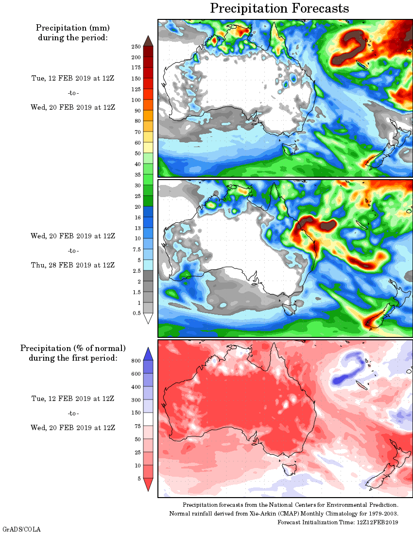
Rainfall outlook:
HAVE YOUR SAY