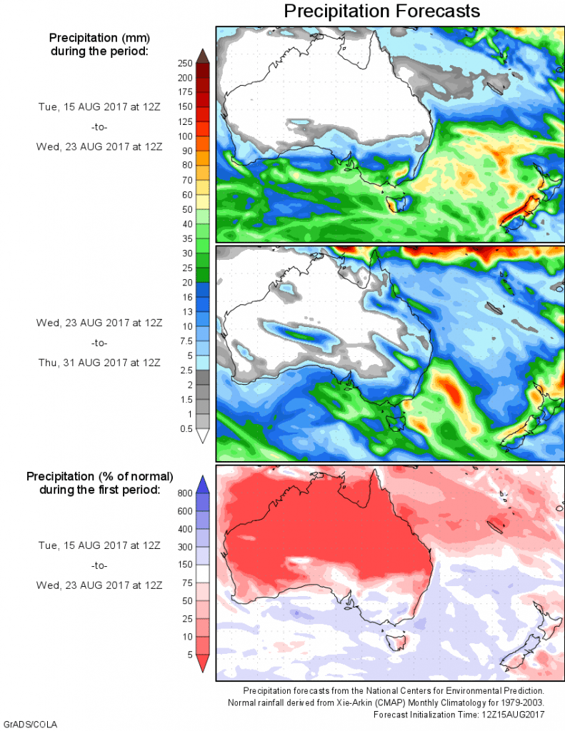
For today’s 14-day rainfall outlook – scroll to bottom of article
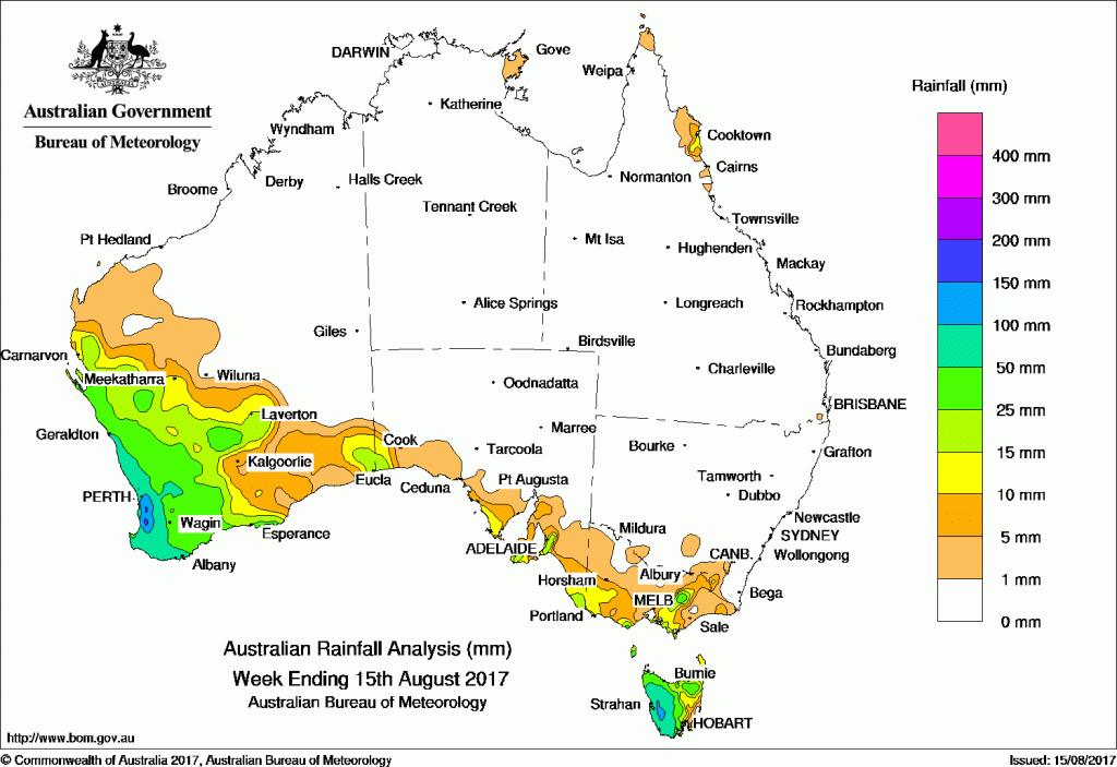
A succession of cold fronts originating from deep low pressure systems crossed southern Australia, with moderate to heavy falls recorded in southwest Western Australia and western Tasmania.
Past seven days: The week began with a strong cold front and associated cloud band moving across Western Australia, and a weak trough passing over Tasmania and southern Victoria. Heavy falls were recorded across the South West Land Division of Western Australia, with lighter falls in the surrounding areas as well as in eastern Victoria, southeastern New South Wales and western Tasmania. Additional light rain also fell around Cape Melville in northern Queensland in response to moist onshore airflow.
By the middle of the week, the strong cold front had moved over eastern Australia, with a low pressure system in its wake. The combination produced light falls along the coast of South Australia and western Victoria, with heavier falls in Tasmania, particularly in the west.
A series of cold fronts crossed the southwestern tip of Western Australia in quick succession towards the end of the week, delivering rain to the western as far north as Kalbarri on the Gascoyne coast and inland to the Goldfields District. As the fronts migrated to the east they also delivered small totals to southern South Australia, western Tasmania and Victoria.
Rainfall totals of more than 50 mm for the week were recorded in the highlands of western Tasmania and the west of the South West Land Division in Western Australia. Areas of higher falls in excess of 150 mm were observed around and south of Perth, including the highest weekly total of 177 mm at Huntly.
Weekly totals of between 25 and 50 mm were recorded in the remainder of the South West Land Division in Western Australia, central and northeastern Tasmania, pockets of the Alpine area of Victoria and the southern coastlines of Victoria and South Australia.
Rainfall totals between 10 and 25 mm were reported around the regions of higher totals across the Southeast Coastal, Gascoyne and Goldfields districts in Western Australia, parts of coastal South Australia, parts of eastern coastal Tasmania, isolated pockets of eastern Cape York Peninsula, and areas of Victoria in the southwest, as well as between the Alps and Mornington and Wilsons Promontory peninsulas.
Little to no rainfall was recorded in northern and eastern Western Australia, the Northern Territory, Queensland, and most of South Australia and New South Wales.
Highest weekly totals list
New South Wales and Australian Capital Territory
10 mm Thredbo AWS*
8 mm Cabramurra Smhea AWS*
5 mm Thredbo Village*
Victoria
49 mm Mount Buller*
41 mm Mt Sunday*
35 mm Mount Useful*
Queensland
9 mm Cooktown Airport
9 mm Hazelmere
7 mm Low Isles Lighthouse
Western Australia
177 mm Huntly
175 mm Jarrahdale
165 mm Dwellingup
South Australia
36 mm Lobethal
33 mm Lobethal (Maidment Road)
30 mm Lobethal, Hahndorf
Tasmania
96 mm Mount Read*
94 mm Warra
92 mm Lake St Clair National Park
Northern Territory
0.8 mm Groote Eylandt Airport, Centre Island
0.6 mm Gove Airport
0.4 mm Port Keats Airport
More weekly rainfall totals:
- NSW/ACT totals click here
- Vic totals click here
- Qld totals click here
- WA totals click here
- SA totals click here
- Tas totals click here
- NT totals click here
Source: BOM


HAVE YOUR SAY