A HUMID air mass over central and eastern Australia combined with a series of troughs during the week, triggering heavy falls, isolated severe thunderstorms, strong winds, high hail accumulations and locally giant hail — larger than 5 cm.
On 17 and 18 October, a deep low pressure system and associated cold front moved across south-eastern Australia and combined with a humid airmass, producing widespread rainfall with some severe isolated thunderstorms and strong winds.
A trough brought several days of rainfall and isolated thunderstorms across western and northern parts of the Top End of the Northern Territory.
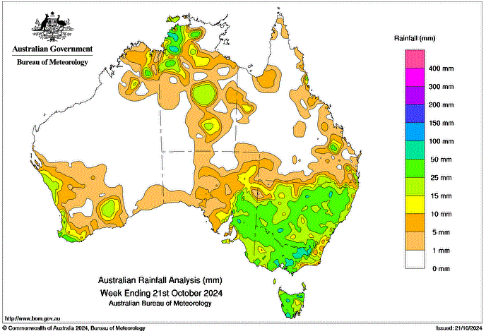
Weekly rainfall totals of 25 to 50 mm were recorded across much of south-eastern Australia, Western Australia’s south-west coast and the western Top End of the Northern Territory
Weekly rainfall totals of 50 to 100 mm were recorded across central parts of Victoria including the ranges and isolated pockets of New South Wales, northern and southern Tasmania, and the western Top End of the Northern Territory.
The highest weekly rainfall total (at a Bureau gauge) was 124.0 mm at Labelle Downs in the Northern Territory, and the highest daily rainfall total (at a Bureau gauge) was 79.0 mm at Thredbo AWS in New South Wales in the 24 hours to 9 am on 19 October.


HAVE YOUR SAY