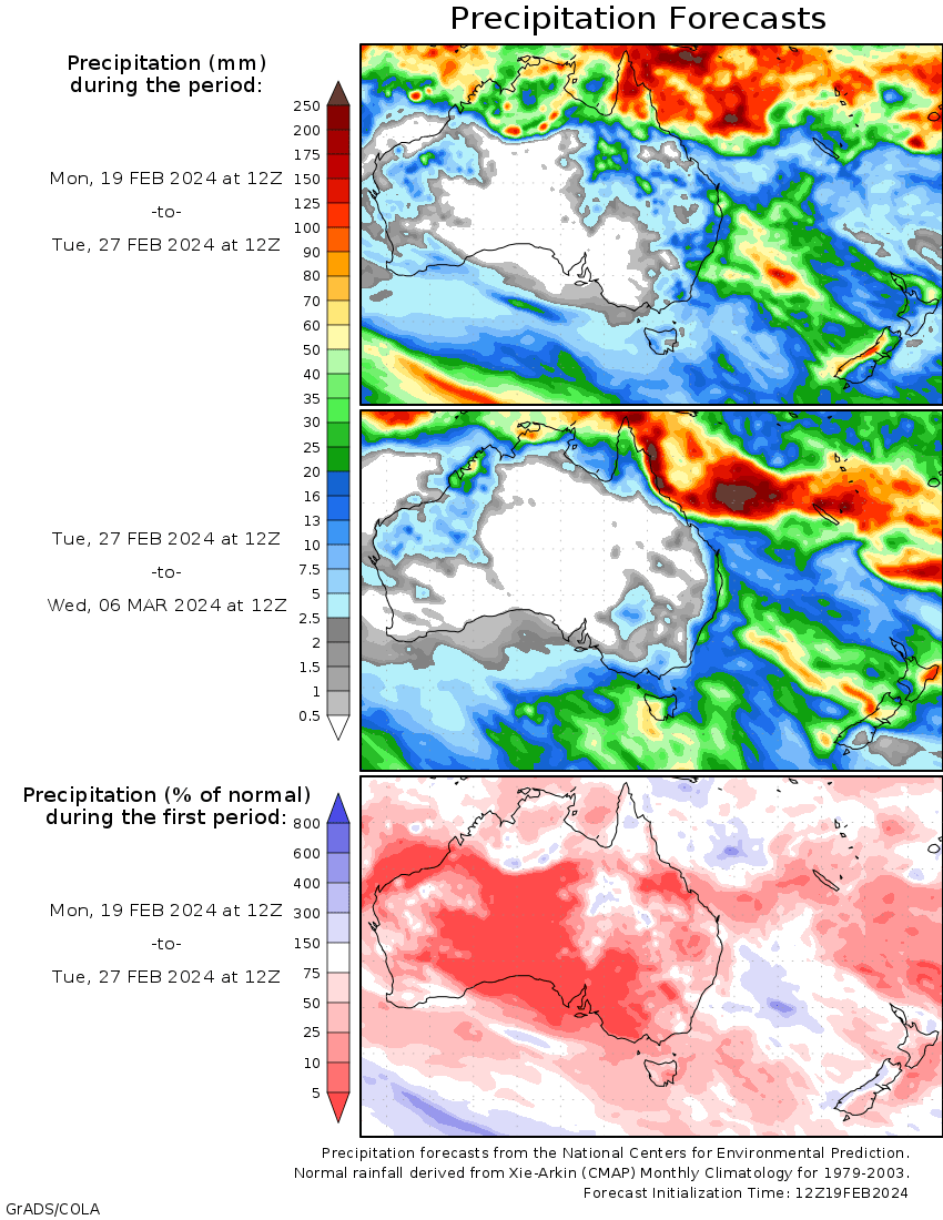
A TROPICAL low (07U) embedded into a monsoon trough developed over the Top End of the Northern Territory at the beginning of the week.
The low moved eastwards across the Top End, along the monsoon trough reaching the Gulf of Carpentaria and bringing heavy rainfall to much of the Gulf coast and parts of northern Queensland during the week.
 Tropical low (07U) strengthened into a Category 1 system, Tropical Cyclone Lincoln and made landfall on the evening of 16 February just west of the Northern Territory – Queensland border.
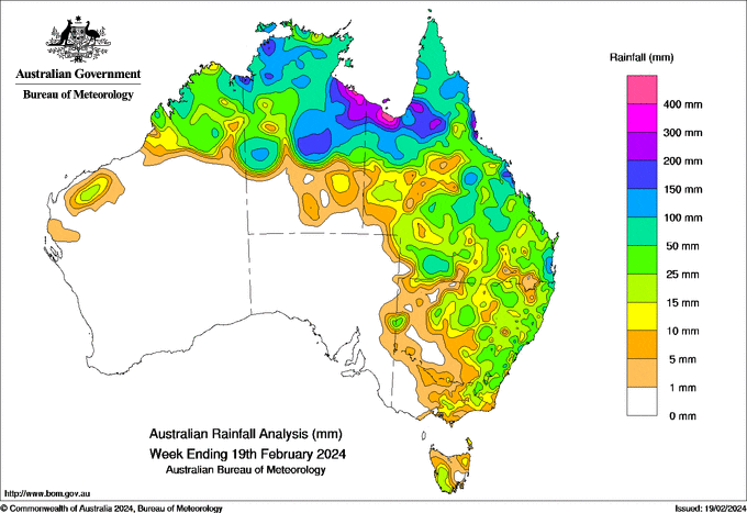
Weekly rainfall totals greater than 150 mm were recorded in an area west of the Top End of the Northern Territory and its central areas, along the south coast of the Gulf of Carpentaria, and in areas of northern Queensland; within these areas there were isolated rainfall totals exceeding 300 mm.
Weekly rainfall totals between 100 to 150 mm were recorded in Queensland’s central and western areas and isolated pockets along the east coast, the Top End of the Northern Territory, and the coastal border of Western Australia and the Northern Territory.
The highest weekly rainfall total was 459.8 mm at Centre Island, Northern Territory.
The highest daily rainfall total during the week was 240.8 mm at Bingil Bay, Queensland, in the 24 hours to 9 am on 17 February.


HAVE YOUR SAY