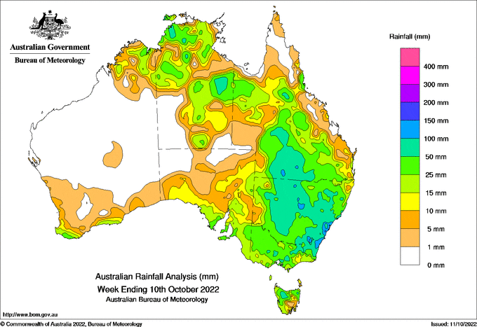
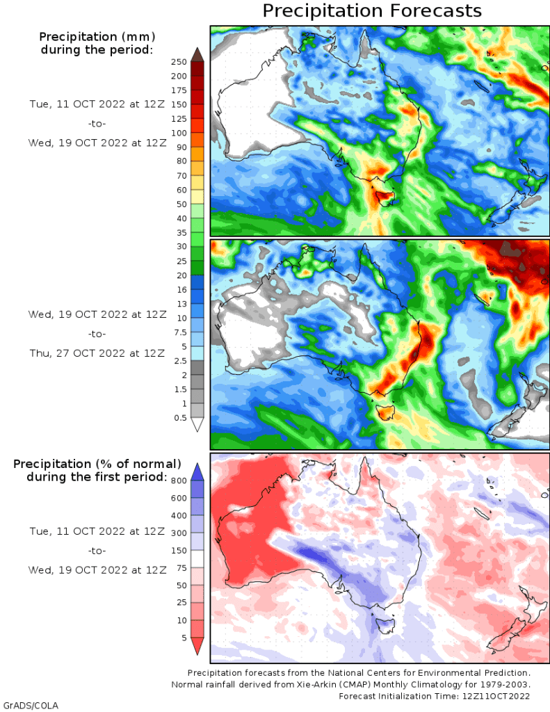
A SERIES of low pressure systems and surface troughs dragged tropical air from the warm ocean waters, delivering thunderstorms and rainfall to large parts of the Northern Territory, eastern and south-eastern Australia.
There is increasing humidity and convective activity / thunderstorms across the tropical north in the lead-up to the wet season.
Weekly rainfall totals above 50 mm were recorded in large parts of New South Wales and southern Queensland; within these, there were areas that received more than 100 mm for the week. Weekly totals above 50 mm were also recorded in parts of the Darwin-Daly and Barkly districts in the Northern Territory, and in pockets across central and north-eastern Victoria and northern Tasmania.
Rainfall totals between 10 mm and 50 mm were recorded in parts of the Kimberley and the southern Western Australian coast, in most of Victoria, Tasmania and New South Wales, in parts of southern and eastern South Australia, and across much of the Northern Territory and Queensland.
The highest weekly total at a Bureau gauge was 194.2 mm at Sydney (Observatory Hill) in New South Wales and the highest daily total was 127.8 mm at Sanctuary Point, New South Wales, in the 24 hours to 9am on 1 October.
Moderate to major flood warnings were issued for many catchments across New South Wales, northern Victoria and southern Queensland. Minor to moderate flood warnings were issued for catchments in north-eastern Tasmania.


HAVE YOUR SAY