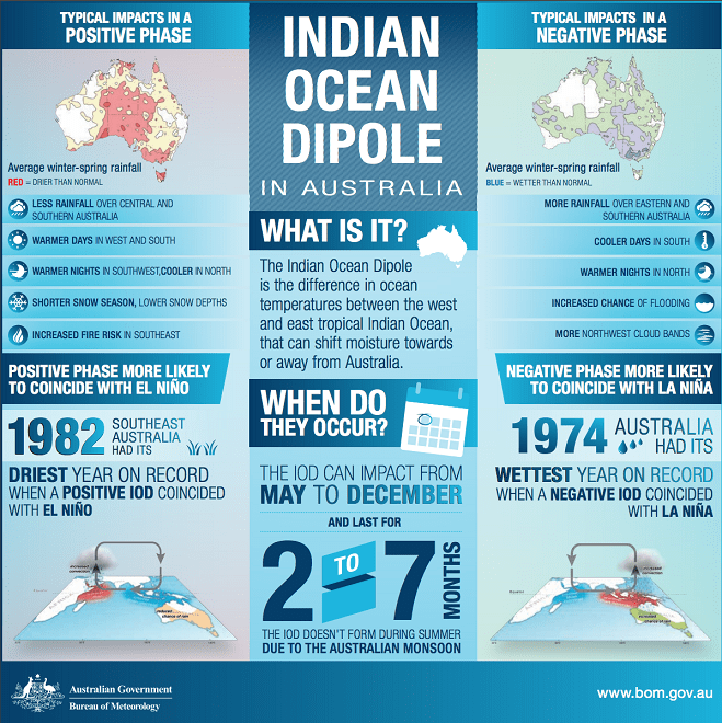
WEATHER forecasting models are pointing to the possibility of a negative Indian Ocean Dipole developing in the Indian Ocean from mid-winter, and a La Niña-like state in the tropical Pacific Ocean in late winter or spring.
The Bureau of Meteorology’s latest fortnightly ENSO outlook says both the El Niño–Southern Oscillation (ENSO) and Indian Ocean Dipole (IOD) are currently neutral.
However, all models surveyed suggest the possibility of a negative IOD developing in the Indian Ocean from the middle of the southern hemisphere winter.

IOD summary. (Source: BOM)
A negative IOD typically results in above-average winter–spring rainfall over parts of southern Australia as the warmer waters off northwest Australia provide more available moisture to weather systems crossing the country.
Some model outlooks also suggest a La Niña-like state in the tropical Pacific Ocean is possible later in the southern hemisphere winter or spring.
La Niña events are associated with wetter than normal conditions across eastern and northern Australia.
While all models show that a negative IOD is more likely than not, individual models show a broad spread of likely scenarios covering both the neutral IOD and negative IOD range.
Additionally, accuracy of IOD forecasts made during autumn have lower accuracy than at other times of year, but accuracy improves in winter.
Key indicators of ENSO, such as the Southern Oscillation Index (SOI), trade winds, cloudiness near the Date Line, and sea surface temperatures in the tropical Pacific Ocean, all persist at levels consistent with neutral ENSO.
However, sea surface temperatures in parts of the tropical Pacific Ocean have dropped by around half a degree in the past fortnight.
Additionally, sub-surface temperatures in the tropical Pacific Ocean continue to decrease, indicating further potential for cooling at the surface in the coming months under the right conditions.
Most climate models surveyed by the Bureau indicate that ENSO is likely to stay neutral through the southern hemisphere winter.
However, in early-to-mid spring, three of the eight models reach or exceed La Niña levels.
Like IOD predictions, ENSO predictions made during autumn tend to have lower accuracy than predictions made at other times of the year.
This means that current ENSO forecasts should be used with some caution.
While the Bureau’s ENSO Outlook is currently at INACTIVE level, criteria will be assessed regularly for elevation to La Niña WATCH.
The Southern Annular Mode (SAM) is currently neutral and forecast to remain neutral for the coming three weeks. As the southern hemisphere winter approaches, SAM may start to be able to influence southern Australian rainfall.
Source: BOM


HAVE YOUR SAY