June-August 2020 rainfall outlook
Click on images to enlarge
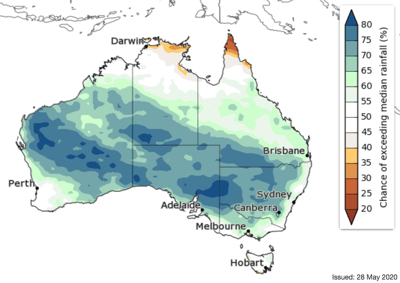
Above average May to July rain likely for southern two-thirds of Australia
June outlook
WINTER (June to August) is likely to be wetter than average for most of Australia (mostly 60–80 percent chance). However, the likelihood of a wetter or drier winter is roughly equal across much of northern Australia, south-west WA, the NSW and Victorian coasts, and Tasmania.
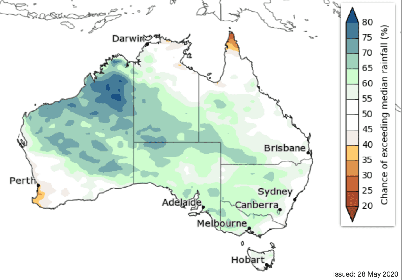
Similarly, July to September is also likely to be wetter than average for most of the southern two-thirds of the continent (60–75pc chance). However, the far south-west and south-east have slightly lower chances.
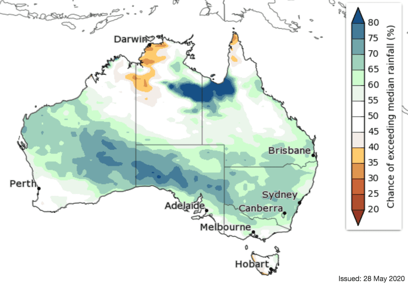
July outlook
While winter overall is likely to be wetter, the week of 1 June to 7 June shows most of the eastern two-thirds of the country, and northern and southern WA are likely to be drier than average (mostly 60-80pc chance). Conversely, the Pilbara in WA is likely to have a wetter than average week.
May marked the official start of the northern Australian dry season. This means tropical northern Australia typically has very low rainfall totals, and only a small amount of rainfall is needed to exceed the median.
‘First look’ July to September rainfall outlook:
Warmer winter days for tropical north and east; cooler for southern mainland
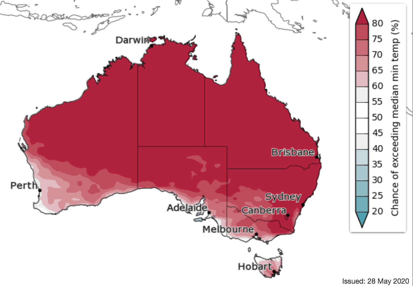
Minimum temperature outlook
Cooler days are likely for the first week June for much of Australia, but south-west Western Australia is likely to be warmer.
Winter (June to August) days are likely to be warmer than average in tropical northern Australia, along the east coast and extending into Tasmania (greater than 80pc chance for the tropical north, mostly 60–80pc in other parts). However, southeast WA, southern SA, south-western NSW and western Victoria are more likely to have cooler winter days (60–75pc chance).
Winter night-time temperatures are very likely to be warmer than average for most of Australia (65–80pc chance for south-west and south-east Australia, greater than 80pc chance elsewhere). The coastlines of south-west WA, south-east SA, western Victoria and northern Tasmania have roughly equal chances of warmer or cooler than average nights.
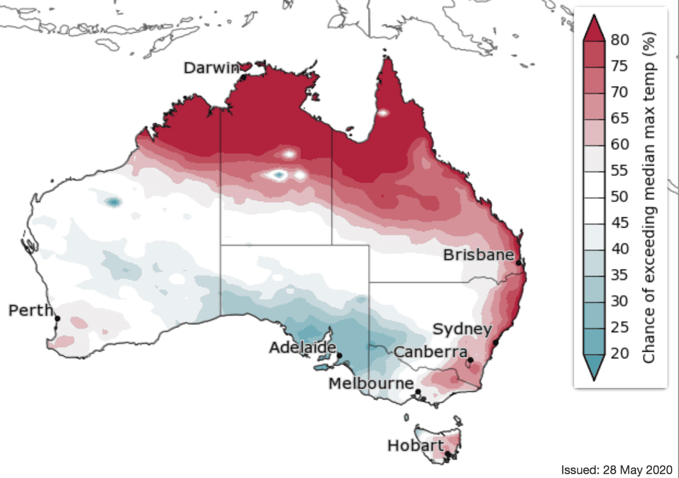
Maximum temperature outlook
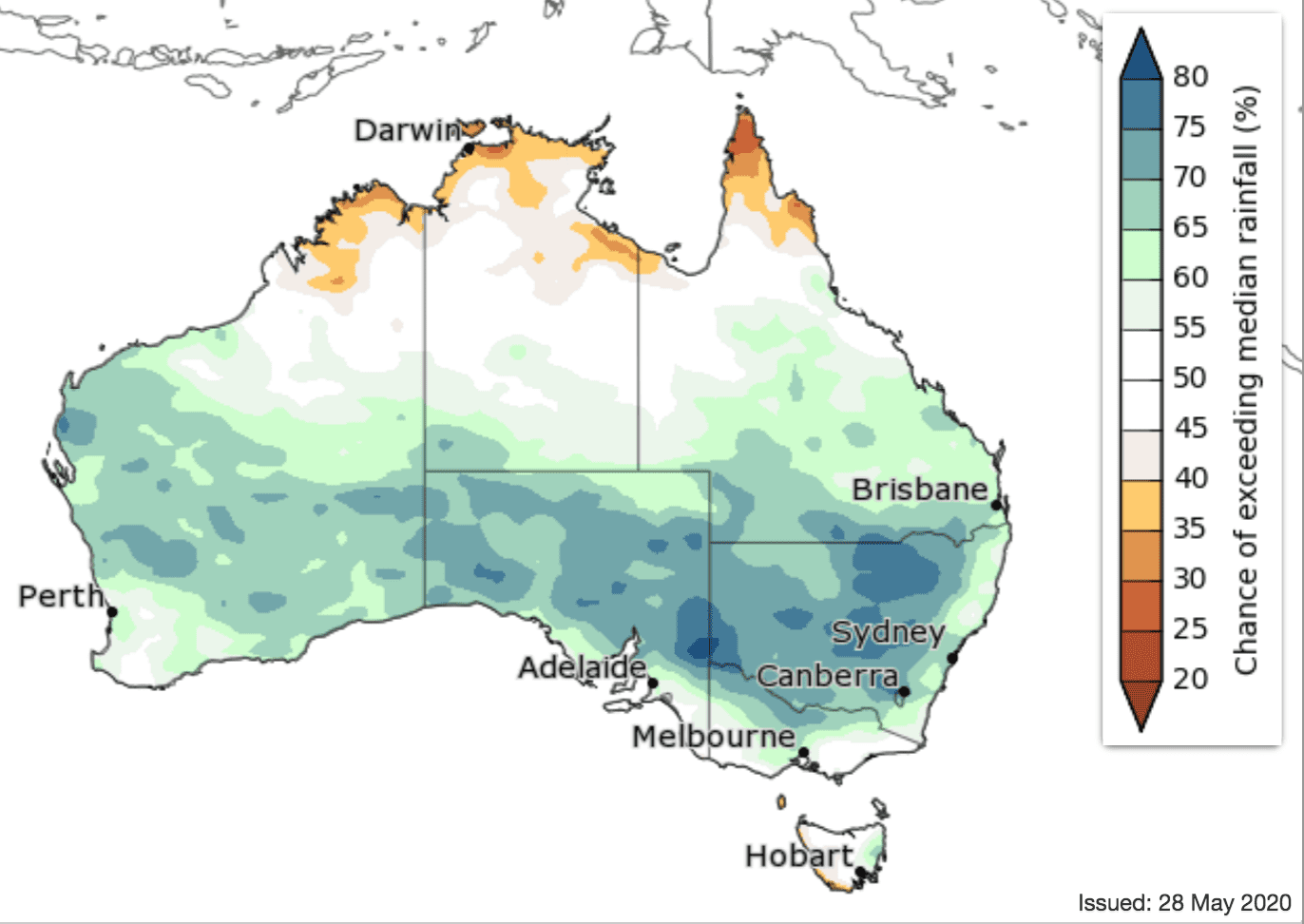
Source: Bureau of Meteorology. To view more outlook maps for coming weeks and months click here
Previous forecast versus actual rainfall
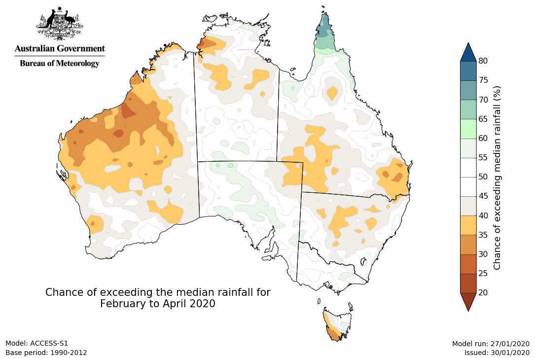
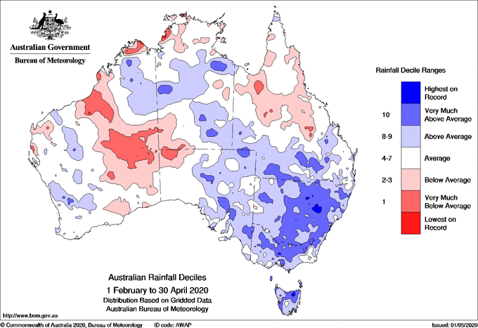
Maps below compare BOM’s rainfall forecast for February to April 2020, issued 30 January 2020, with actual rainfall recorded over the February to April 2020 period.
FORECAST MEDIAN RAINFALL FEB 2020 to APR 2020:
ACTUAL RAIN RECORDED FEB 2020 to APR 2020
Source: Bureau of Meteorology
HAVE YOUR SAY