July-September 2020 rainfall outlook
Wetter months likely for late winter to early spring
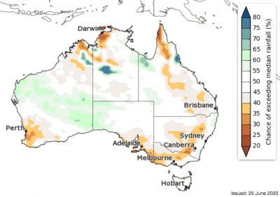
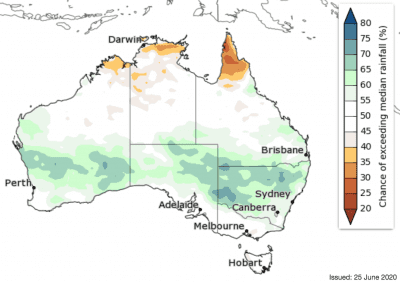
THE next fortnight from 29 June to 12 July is likely to be drier than average for most of Australia, with mostly a 60–75 percent chance of rainfall, and a greater than 75 percent chance in some inland south-east areas.
However, there are close to equal chances of a wetter or drier fortnight in much of western and south-eastern Western Australia, western Tasmania, and parts of the eastern seaboard.
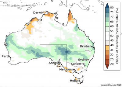
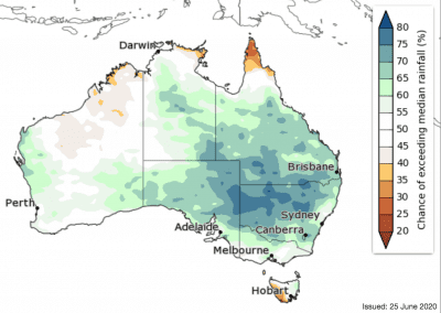
However, looking longer-term, August to October is likely to be wetter than average for most of the eastern mainland, the Northern Territory, South Australia, and parts of western and south-eastern Western Australia (60–80pc chance). Western Tasmania is likely to be drier than average (65–75pc chance).
The northern Australian dry season spans May through September. Tropical northern Australia typically has very low rainfall totals during the dry season and only a small amount of rainfall is needed to exceed the median.
‘First look’ August to October rainfall outlook:
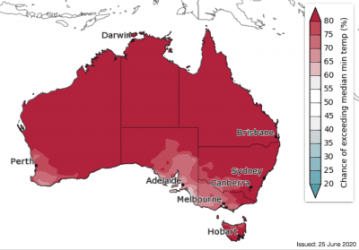
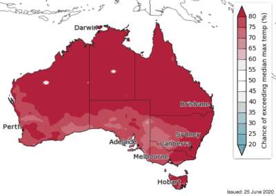
Warmer days and nights for most of Australia
Daytime temperatures for the next two weeks (29 June to 12 July) are likely to be warmer than average for most areas; likely 2–4 degrees warmer than usual for much of the north-west and northern interior of WA, and up to 2 degrees warmer than average for the remainder of Australia.
For 29 June to 12 July, nights are likely to be warmer than average for the west, north, eastern seaboard, and Tasmania. Chances of warmer or cooler nights are roughly equal for much of the inland south-east and South Australia.
Days during July to September are very likely to be warmer than average across most of Australia (greater than 80pc chance for the northern half of Australia, mostly 70–80pc in other parts).
Likewise, night-time temperatures for July to September are very likely to be warmer than average for Australia (generally 65–80pc chance for south-east SA, much of Victoria, and inland southern to south-western NSW; greater than 80pc chance elsewhere).
Source: Bureau of Meteorology. To view more outlook maps for coming weeks and months click here
Previous forecast versus actual rainfall
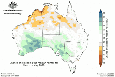
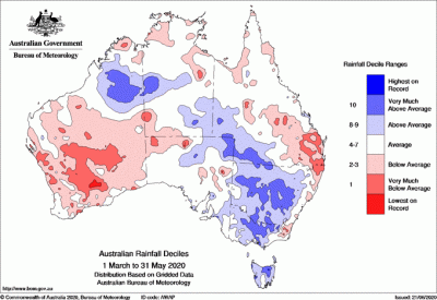
Maps below compare BOM’s rainfall forecast for March to May 2020, issued 27 February 2020, with actual rainfall recorded over the March to May 2020 period.
FORECAST MEDIAN RAINFALL MARCH 2020 to MAY 2020:
ACTUAL RAINFALL RECORDED MAR 2020 to MAY 2020:
Source: Bureau of Meteorology

HAVE YOUR SAY