SCATTERED storms and showers over the eastern portion of the continent have helped to reduce the rate of pasture decline.
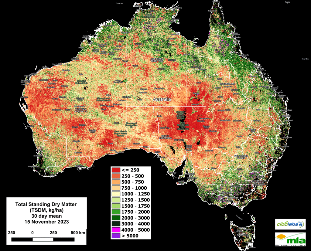
Looking at the national position, there have been only slight changes in the level of total standing dry matter in the past two weeks, reflecting the variation in rainfall and the ongoing bushfire impact in several states.
Total Standing Dry Matter
The national average amount of total standing dry matter has generally stabilised below 1250 Kg DM/Ha.

Imagery and analysis provided by CiboLabs
Recent storm and shower events have slightly increased total standing dry matter levels on the north-west slopes and northern tablelands of New South Wales.
Much of Queensland, Victoria and the other southern states remain substantially unchanged in the two weeks leading to the 15th of November (Figure 1).
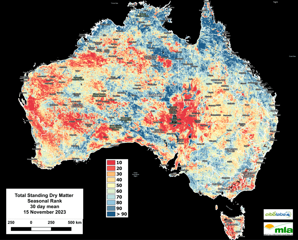
Seasonal comparison of Total Standing Dry Matter
While some growth has occurred due to recent rainfall, the overall position of the continent remains below and well below average for the seasonal levels of Total Standing Dry Matter.
Western Australia remains stable, with areas considered below and well below seasonal averages. (Figure 2).
Fractional Cover (Growth)
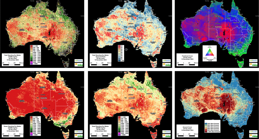
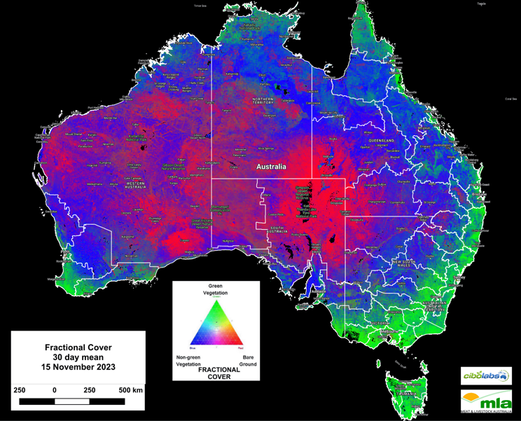
Pasture biomass growth events (as indicated by Fractional Cover – Image 3) continue to reflect the impact of the stormy weeks leading to the 15th of November.
Most growth events remain restricted to these coastal regions across Victoria and Tasmania. The effect of storm events in the eastern portions of the NSW central west, north-west and tablelands is becoming noticeable.
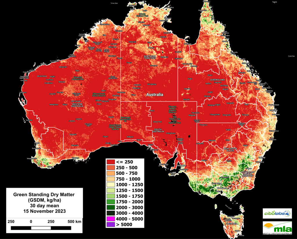
Green Total Standing Dry Matter
Green standing dry matter levels remain very low for most of the continent.
The impact of rain and the growth in response has not yet taken levels of green pasture biomass to levels above 500 kg/DM/Ha for most of the country, except for Victoria and central Tasmania and the south-west slopes of NSW. (Image 4).
Livestock managers will need to continue budgeting for low levels of green biomass in their feeding and grazing plans as these levels remain below the benchmarks for all classes of livestock.
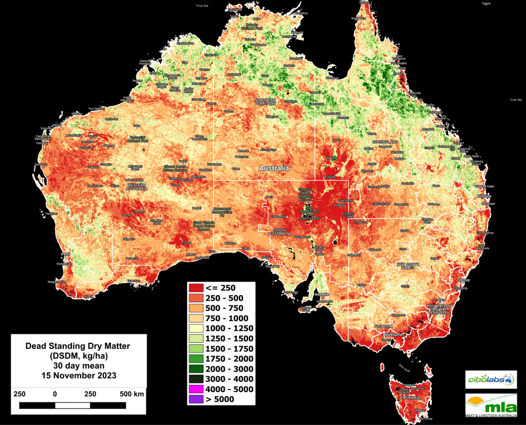
Dead Standing Dry Matter
Dead standing dry matter remains largely unchanged in the most recent satellite update. (Image 5).
Areas greater than 1200kg DM/Ha remain confined largely to north-eastern Queensland and parts of the Barkly Tablelands.
One exception has been the south-east of South Australia, where levels of dead standing dry matter have increased in recent weeks to exceed 1500kg / DM /Ha.
This reflects the maturing of Winter crops ahead of harvest.
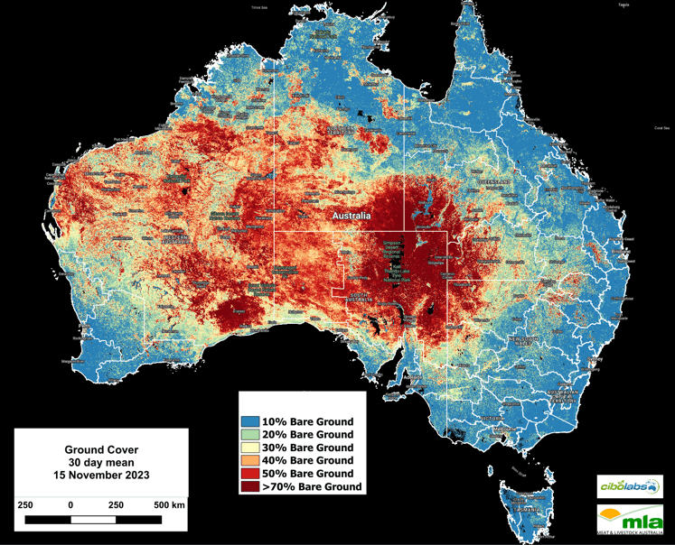
Monthly Ground Cover levels
National ground cover levels (30-day rolling average – Image 6) have not dramatically increased for most of the continent.
However, the loss of ground cover due to bushfire is evident in the Queensland Darling Downs and border region with NSW.
The widespread fires in the North Barkly and north of Mount Isa as well as in the eastern Kimberley region of Western Australia can also be noted in the most recent update.
It is important for users to note that these national images can be refined to provide more detail on a regional basis using the Cibo Labs Regional Comparison. This can be used to focus on regional level data which may show the impact of localised weather or fire events. A further level of detail for individual properties is available for users who have created an Australian Feedbase Monitor account, which can be accessed both through the MyMLA portal or through the Cibo Labs website.
The Cibo Labs National Comparison can be used to freely access these layers (https://www.cibolabs.com.au/products/national-comparsion/) to view the most recent images from a national, state or catchment level.
This tool can complement the Australian Feedbase Monitor which can also be created within the Cibo Labs Web Site www.cibolabs.com.au

HAVE YOUR SAY