THE chance of above-average rainfall across northern and eastern Australia during summer increased with the Bureau of Meteorology today declaring a La Niña has developed in the Pacific Ocean.
The bureau said La Niña is part of a cycle known as the El Niño-Southern Oscillation (ENSO), a naturally occurring shift in ocean temperatures and weather patterns along the equator in the Pacific Ocean.
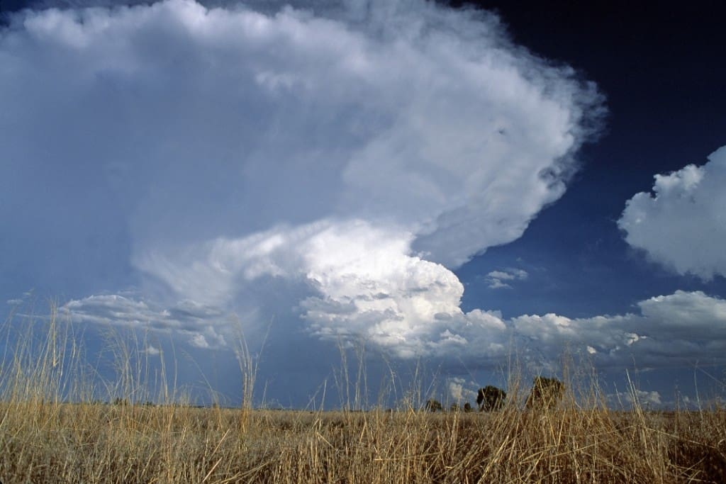
During La Niña, waters in the central or eastern tropical Pacific become cooler than normal, persistent south-east to north-westerly winds strengthen in the tropical and equatorial Pacific, and clouds shift to the west, closer to Australia, the bureau said.
The bureau’s head of operational climate services, Dr Andrew Watkins, said that typically during La Niña events, rainfall becomes focused in the western tropical Pacific, leading to wetter than normal period for eastern, northern and central parts of Australia.
“La Niña also increases the chance of cooler than average daytime temperatures for large parts of Australia and can increase the number of tropical cyclones that form.
“La Niña is also associated with earlier first rains of the northern wet season, as we’ve observed across much of tropical Australia this year,” Dr Watkins said.
“The last significant La Niña was 2010–12.
“This strong event saw large impacts across Australia, including Australia’s wettest two-year periods on record, and widespread flooding,” he said.
“La Niña also occurred during spring and summer of 2020-21. Back-to-back La Niña events are not unusual, with around half of all past events returning for a second year.”
Dr Watkins said that this year’s event is not predicted to be as strong as the 2010-12 event and may even be weaker than in 2020-21 La Niña event.
“Every La Niña has different impacts, as it is not the only climate driver to affect Australia at any one time.
“That’s why it is important not to look at it in isolation and use the Bureau’s climate outlooks tools online to get a sense about likely conditions for the months ahead,” Dr Watkins said.
The Bureau previously shifted to La Niña WATCH on 14 September 2021, and to La Niña ALERT on 12 October 2021. La Niña is likely to persist until at least the end of January 2022, with climate models suggesting this La Niña will be short-lived, persisting until the late southern hemisphere summer or early autumn 2022.
The bureau said several indicators of the El Niño–Southern Oscillation (ENSO) now show clear La Niña patterns. Sea surface temperatures in the tropical Pacific are close to La Niña thresholds, with climate model outlooks expecting them to cool further. In the atmosphere, cloud and wind patterns are typical of La Niña, indicating the atmosphere is now responding to, and reinforcing, the changes observed in the ocean.
The negative Indian Ocean Dipole (IOD) is approaching its end, with oceanic index values in the neutral range. However, cloud and wind patterns across the eastern Indian Ocean suggest some IOD influence remains. All models indicate the IOD will remain neutral for the coming months, consistent with its typical seasonal cycle. A negative IOD increases the chances of above-average spring rainfall for much of southern and eastern Australia.
The Madden–Julian Oscillation (MJO) is currently over the Maritime Continent region at weak to moderate strength. The MJO is forecast to progress eastwards across the Maritime Continent and into the western Pacific over the coming fortnight, increasing the chances of above average rainfall across northern Australia and the Maritime Continent, to Australia’s north.
The Southern Annular Mode (SAM) has generally been positive for several weeks. It is forecast to remain at positive levels to the end of the year. A positive SAM during summer typically brings wetter weather to eastern parts of Australia, but drier than average conditions for western Tasmania.
Climate change continues to influence Australian and global climate. Australia’s climate has warmed by around 1.44 °C for the 1910–2019 period. Rainfall across northern Australia during its wet season (October–April) has increased since the late 1990s. In recent decades there has been a trend towards a greater proportion of rainfall from high intensity short duration rainfall events, especially across northern Australia.
Download the audio from today’s press conference here.
For more information about climate drivers, visit the bureau’s website.
HAVE YOUR SAY