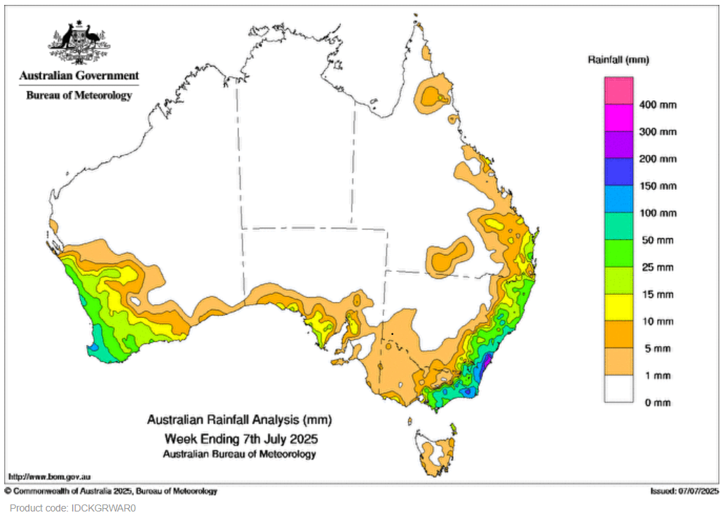
A DEEP low pressure system and associated troughs in coastal New South Wales triggered widespread rainfall over eastern parts of the state, as well as parts of south-eastern Queensland and eastern Victoria.
 An upper level low triggered storms, some severe, over eastern New South Wales on 6 July.
Weekly rainfall totals of 25-300 mm were recorded across coastal regions of New South Wales, eastern Victoria and isolated patches in south-eastern Queensland.
Cold fronts and associated low pressure systems and troughs led to scattered rainfall and storms, some severe, across south-western parts of Western Australia, coastal regions of South Australia, New South Wales, Victoria and Tasmania.
Weekly rainfall totals of 15-100 mm, and locally higher falls, were recorded across the south-west of Western Australia and patches of southern coastal regions of South Australia.
The highest weekly total at a Bureau of Meteorology gauge was 341.4 mm at Jervis Bay (Jervis Bay Airfield AWS) in New South Wales.
The highest daily total at a bureau gauge was 224 mm at Ulladulla AWS in New South Wales in the 24 hours to 9am on 2 July.
H