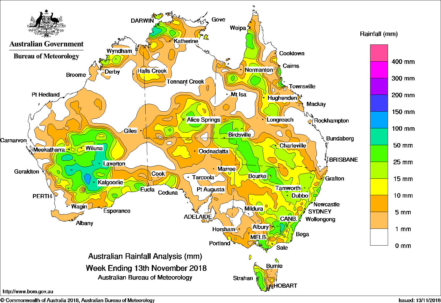
A CLOUD band produced moderate falls from central to south-east Australia, and surface troughs resulted in moderate falls across the west, central and east of Australia.
Past seven days: At the start of the week, a cloud band developed and extended from central Australia to the Tasman Sea associated with broad areas of low pressure stretching from the north-west down to the south-east of the continent. Extensive thunderstorm and shower activity resulted in moderate falls across central Australia, south-west Queensland, and north-eastern South Australia. Warm and moist tropical air was dragged into the south-east, ahead of a strong cold front, with embedded thunderstorms generating moderate falls in southern central and north-eastern Victoria, parts of southern New South Wales, and western Tasmania. As the cold front and trough moved eastwards, further moderate falls were recorded in southern Queensland, and in northern and eastern New South Wales.
In the second half of the week, a broad surface trough reached from inland Western Australia to the Top End of the Northern Territory and across into the northern tropics of Queensland. Showers and thunderstorms developed along and near the deepening surface trough inland from the west coast, bringing moderate to locally heavy falls to central, eastern parts of the South West Land Division, and the south-east coast of Western Australia. Thunderstorms and moderate falls were also recorded about the north-west Top End of the Northern Territory. In the east, an onshore south-easterly flow produced showers and moderate to locally heavy falls about the north tropical Queensland coast, while an inland surface trough and associated thunderstorms over the gulf country and northern interior of Queensland produced moderate falls in the area.
At the end of the week, the surface trough and associated cloud band moved eastwards to the south-east of Western Australia, with further thunderstorm and shower activity generating moderate falls in the goldfields district and about the State’s south-east coast.
Rainfall totals exceeding 50 mm were observed in the north-west Top End of the Northern Territory, the north tropical coast of Queensland, small areas of south-eastern New South Wales, and south-east Gascoyne, Goldfields and southern interior of Western Australia. Isolated falls exceeding 100 mm were recorded in areas of the goldfields district in Western Australia; also a small area in the north tropical Queensland coast, including the highest weekly total of 157 mm at Mutarnee Store.
Rainfall totals between 25 mm and 50 mm were recorded across large parts of central and small areas of south-east Western Australia; in the north-west Top End and southern parts of the Northern Territory; areas of northern and south-west Queensland; north-west, south-east and east coast New South Wales; north-eastern and southern central Victoria, and western Tasmania.
Rainfall totals between 10 mm and 25 mm were recorded across much of the central south-east coast and west Kimberley in Western Australia; in the north-west and southern parts of the Northern Territory; parts of the tropical north, central and southern Queensland; most of New South Wales away from the south-west; small areas in the north and south-east of South Australia; southern and eastern Victoria, and the western half of Tasmania.
Little or no rainfall was recorded in remaining parts of the continent.
Highest weekly totals
New South Wales and Australian Capital Territory
77 mm Cabramurra AWS
62 mm Perisher Valley Aws
58 mm Thredbo AWS, Wingham (Lanark Close)
Victoria
47 mm Essendon Airport
46 mm Monbulk (Spring Road)
45 mm Mount Hotham
Queensland
157 mm Mutarnee Store
89 mm Rollingstone
54 mm Innisfail
Western Australia
123 mm Credo
107 mm Allan Rocks
86 mm Cue
South Australia
18 mm Gammon Ranges (Moolawatana)
14 mm Nullarbor
12 mm Tieyon
Tasmania
60 mm Mount Read
44 mm Strahan Aerodrome
36 mm Warra, Strahan (Andrew Street)
Northern Territory
141 mm Labelle Downs
103 mm Geriatric Park
83 mm Walker Creek
More weekly rainfall totals:
- NSW/ACT totals click here
- Vic totals click here
- Qld totals click here
- WA totals click here
- SA totals click here
- Tas totals click here
- NT totals click here
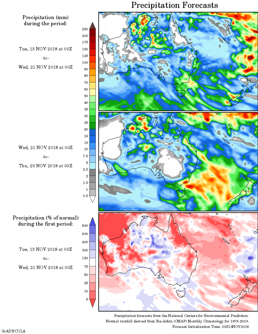
Rainfall outlook:
HAVE YOUR SAY