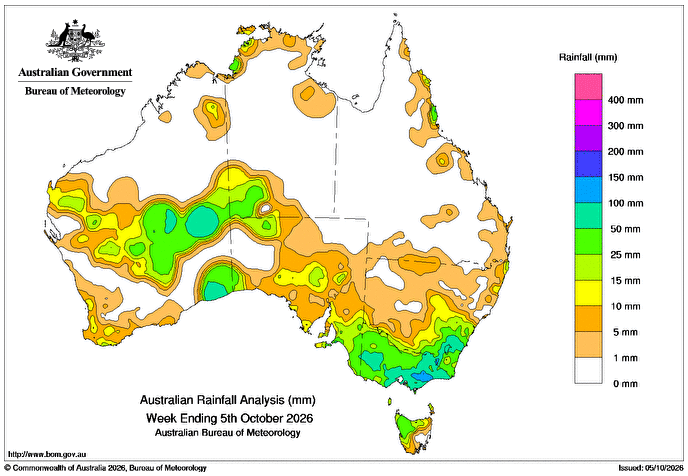
DURING the week, a slow moving low pressure trough produced several days of rainfall and isolated thunderstorms across western and inland parts of Western Australia.
In Western Australia, weekly rainfall totals of 10-50mm were recorded in the Gascoyne, Southern Interior, Goldfields and Eucla, and other large areas recorded falls exceeding 50mm.
On 1 October, a cloud band of tropical moisture associated with a low pressure trough brought rainfall to central and south-eastern parts of Australia.
A low pressure system formed near the New South Wales-Victoria border on 2 October, producing persistent and widespread rain along with isolated thunderstorms before moving offshore on 4 October.
Flood watches were issued across central and northern Victoria, with minor to major flood warnings issued for some catchments.
Weekly rainfall totals of 10-100mm were recorded across Victoria, south-eastern South Australia, south-eastern and inland areas of NSW, and western and northern Tasmania. Falls greater than 100mm were recorded in parts of eastern Victoria.
Throughout the week, moist onshore winds generated scattered showers to parts of the north-eastern coast of Queensland.
Weekly rainfall totals of 15-50mm were recorded across Queensland’s North Tropical Coast and Tablelands and the Herbert and Lower Burdekin districts.
The highest weekly total at a Bureau of Meteorology gauge was 216mm at Lorne, Mount Cowley in Victoria, including the highest daily total of 103mm in the 24 hours to 9am on 3 October.
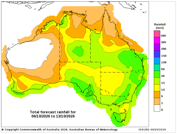
Rainfall outlook map