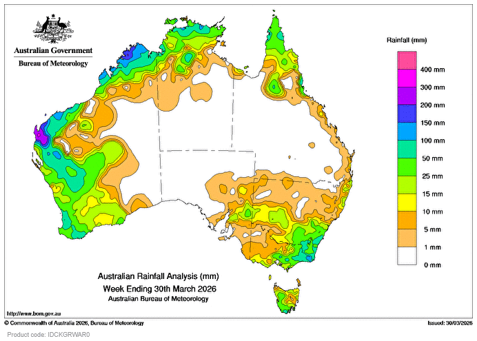
SEVERE Tropical Cyclone Narelle made its third landfall south of Coral Bay in Western Australia on March 27, bringing rainfall to much of WA’s north and west and to parts of the Top End of the Northern Territory as it tracked across northern Australia and turned to the south-west.
Weekly rainfall totals of 50-200mm, and locally higher, were recorded across northern and western parts of WA and isolated areas across the Cape York Peninsula and the north-eastern coast of Queensland and the NT’s Top End.
A trough and cold front that moved across south-east Australia combined with a humid, unstable airmass to produce thunderstorms, some severe, leading to heavy rain over parts of the region.
Weekly rainfall totals of 25-100mm, and locally higher, were recorded across large parts of eastern Victoria, western and southern parts of Tasmania, south-eastern New South Wales and isolated western areas of South Australia.
The highest daily total at a Bureau of Meteorology gauge was 328mm in the 24 hours to 9am on 28 March at Winning in WA during the passage of Severe TC Narelle; this was also the highest weekly total at a bureau gauge for the week ending 9am 30 March.
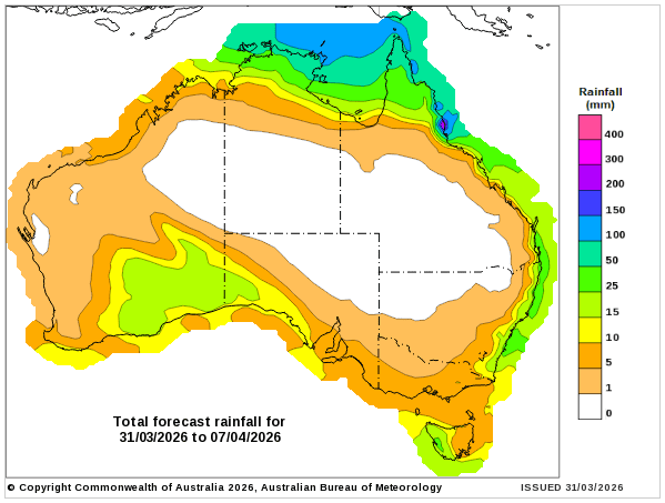
Rainfall outlook map
HAVE YOUR SAY