
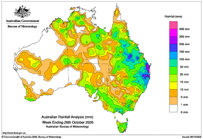
A SLOW-MOVING high-pressure system in the Tasman Sea this week directed humid air into low-pressure troughs generating showers and thunderstorms, some severe, across parts of eastern and northern Australia.
Weekly rainfall totals of 10-100mm were recorded across most of Queensland, northern and eastern New South Wales, and areas of central and northern Western Australia and the Northern Territory.
Falls greater than 100mm were recorded in parts of central and south-eastern Qld and north-eastern New South Wales, with totals above 200mm in areas of Qld’s Wide Bay and Burnett and south-east coast districts.
Minor to major flood warnings were issued for many catchments in southern Qld.
Cold fronts and low-pressure troughs crossed parts of southern Australia, bringing widespread rainfall, showers and thunderstorms.
Weekly rainfall totals of 10-100mm were recorded in the far south-west of Western Australia, parts of southern South Australia, most of Victoria and adjacent areas of south-eastern NSW, and across Tasmania.
The highest weekly total at a Bureau of Meteorology gauge was 393mm at Lower Springbrook Alert in Qld.
The highest daily total at a bureau gauge was 212mm at Brooweena TM in Qld in the 24 hours to 9am on 25 October.
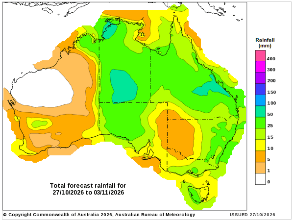
Rainfall outlook map
HAVE YOUR SAY