
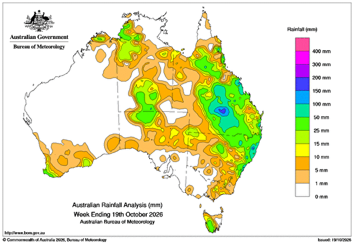
THUNDERSTORMS brought weekly rainfall totals of 15mm to more than 50mm in central Australia, including around Alice Springs.
On 13 October, a cold front moving up the east coast connected with an inland trough, resulting in heavy rain along the central-east coast and daily rainfall totals of 25mm to more than 50mm around Sydney.
Throughout the week, inland troughs triggered thunderstorms and showers across parts of the north, where weekly rainfall totals of 5-50 mm were recorded, and large areas of the east had over 25mm.
Parts of Queensland and coastal north-eastern New South Wales recorded weekly totals of 50-200mm.
Consecutive days of heavy rainfall resulted in minor to major flooding in south-eastern Queensland.
Cold fronts triggered weekly rainfall totals of 5-50mm along parts of the south-west coast of Western Australia and in south-western Tasmania.
The highest weekly total at a Bureau of Meteorology gauge of 217mm was recorded at Mount Jukes in Qld.
The highest daily total of 106mm was recorded at Chatswood Bowling Club in NSW in the 24 hours to 9am on October 14.
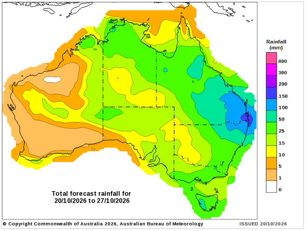
Rainfall outlook map
HAVE YOUR SAY