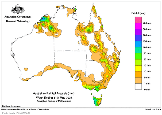
A SERIES of cold fronts and low-pressure troughs crossed south-eastern Australia during the week, bringing light to moderate rainfall totals.
 Weekly rainfall totals of 10-50mm were recorded across Tasmania and southern, central and eastern parts of Victoria, with falls greater than 50mm in western Tasmania and in central Victoria.
A series of low-pressure troughs and moist onshore winds brought rainfall and isolated storms to northern parts of the country and some areas of Queensland and New South Wales.
Weekly rainfall totals of 10-50mm were recorded in an area of Northern Territory’s eastern Top End, in western, southern and northern parts of Qld, in northern NSW and parts of the Kimberley in Western Australia, which also saw locally higher totals.
The highest weekly total at a Bureau of Meteorology gauge was 163mm at Mount Read in Tasmania.
The highest daily total at a bureau gauge was 98mm at Cape Wessel in the Northern Territory in the 24 hours to 9am on 10 May.
Rainfall outlook map to 19 May

HAVE YOUR SAY