
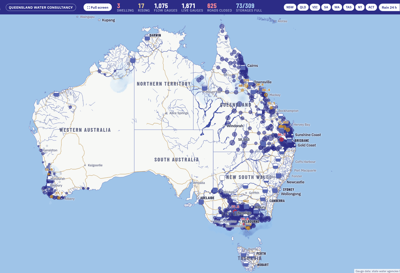
Queensland Water Consultancy’s live map has been available free of charge to visitors to its website since last month. Image: QWC
A LIVE map that aggregates information from state and federal agencies is racking up the clicks for Queensland Water Consultancy.
It shows river flows, dam heights, road closures and rainfall across Australia, and – just like water – it does net let state borders stand in its way.
The map is the brainchild of Brisbane-based lawyer Matthew Donovan, who in 2013 founded QWC to broker and value water entitlements and irrigated properties.
Hence, Mr Donovan could see a case for a map that tracked river flows, and not just in the much-watched Murray Darling Basin.
These days, Mr Donovan runs QWC with his lawyer and consultant daughter Grace Donovan, and said the map reveals flows available to primary producers and regional communities, legislation permitting.
“When you see the water that’s travelling down rivers on this map, you realise there are enormous volumes going into Lake Eyre, or into the ocean,” Mr Donovan said.
“Provided it doesn’t impact environmental flows, I think it should be transferable.”
Romanian connection
Mr Donovan’s wife is Romanian, and a chance conversation with their software developer niece while the family was in Romania led to the building of the map.
“I was talking to Alexandra about what I had in mind, and she said she could build it, so she did.”
The map uses plug-ins from the likes of the Bureau of Meteorology for national rainfall data, Sunwater for Qld dam heights and river flows, and WaterNSW for the equivalent in New South Wales.
It also incorporates road closures in all Australian jurisdictions, and after being available to subscribers for some weeks, it became publicly available for free during Qld’s big rain event late last month.
“It led to a 5000-percent increase in traffic on our website.”
Water shortage carries cost
Much of QWC’s client base is in Qld and includes feedlots and mixed farms as well as established and developing irrigators of fodder and cash crops.
 Mr Donovan said his business looks not just at the cost of water, and the development of infrastructure to best utilise it, but also the cost of not having water.
“One of the things that drove me to look into this map was a client in Central Queensland who had spent $1 million on trucking hay up from Victoria for his cattle.
“He was trying to build a dam to grow hay to droughtproof his property as an alternative to having to make outlays like this.”
Mr Donovan is advocating for agricultural producers in Qld to be allowed to store up to 1000ML of overland and/or peak-flow water.
He said this would allow them to create cashflow, or underpin existing production by eliminating or reducing the need to buy in fodder.
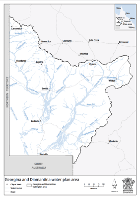
In what he sees as a step in the right direction, the Qld Government has released a draft of its Georgina and Diamantina water plan.
It covers 266,000km2 of western Qld, and looks to double identified unallocated overland flow from 13,500ML to 27,000ML for specified uses.
In a statement, the Qld Govt said this increased amount, and the introduction of new reserve categories would provide greater flexibility for future economic development, community needs and projects of Qld and regional significance.
“We want to deliver a water plan that strikes the right balance and supports ongoing livestock production and supports the long-term water security, prosperity and sustainability of Western Queensland,” Qld Minister for Local Government and Water
Ann Leahy said.
Tradability brings flexibility
Mr Donovan has provided input into the draft plan, which is open for feedback until December 16, and hopes Qld Govt reforms will open the door to more water trading, particularly as opportunities emerge for cropping in Qld’s north.
“We trade very little water compared with NSW.
“A major problem in Queensland is that people cannot easily transfer water licences; there are many unnecessary restrictions which result in one farmer having water he cannot use, and another who wants it not being able to buy or transfer it due only to red tape.
“I think catchments should maintain environmental flows, but be able to capture amounts above that, particularly in peak-flow events.
“Part of the idea for this map was to allow people to see what water’s getting around and what’s coming down from upstream, and being able to plan, as well as understanding where the shortfalls are in dry periods, and where the excesses are occurring.”

QWC principal Matt Donovan with his daughter and QWC consultant Grace Donovan.
Aside from demand for water from irrigated cropping, mining, and construction, Mr Donovan said the expanding feedlot industry was also having an impact on per-megalitre values.
“Great Artesian Basin water is trading at $30,000-$40,000/ML, and that’s because two-thirds of all of Australia’s feedlot cattle are in southern Qld.”
He said water trading could cap the expense of water available to feedlots, who get through around 100ML per year per 5000 head, and create income for those not wishing to use the water themselves.
For those with river allocations, QWC’s live map will soon be upgraded to show when streamflow will arrive at a user-determined point.
“If you’re an irrigator at St George, you’re going to want to know when that volume coming down the Condamine is going to get to your place.
“That’s something we’re planning to add to the map.
“Our business is water, and our clients are people who rely on streamflow.”
The map can be accessed via the Queensland Water Consultancy website.
Grain Central: Get our free news straight to your inbox – Click here
HAVE YOUR SAY