
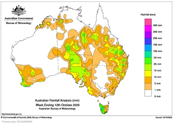
FROM 6 to 8 October, an inland trough interacting with a low pressure system east of Australia produced generally light patchy showers in inland and the south-east of Queensland, and in north-eastern New South Wales. Weekly rainfall totals of 5 to 25 mm, locally higher, were recorded across the region.
 A series of cold fronts crossed southern Australia during the week, bringing weekly totals of 5 to 50 mm, locally higher, along parts of the coast in south-western Australia and to western Tasmania.
Between 8 and 11 October, fronts over southern Australia connecting with an inland trough resulted in storms and showers across northern-inland areas and South Australia. Large areas through the Northern Territory, into western Queensland and through South Australia recorded weekly rainfall totals of 5 to 25 mm and lower totals were recorded in the south-east.
The highest weekly total (at a Bureau gauge) of 89.2 mm was recorded at Mount Read (Tasmania).
The highest daily rainfall total was 49.8 mm at Gladstone Airport in Queensland, in the 24 hours to 9 am on 8 October 2026.
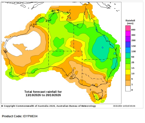
Seven-day rainfall outlook
HAVE YOUR SAY