
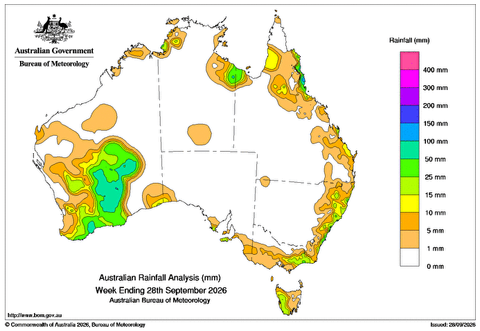
A SLOW-moving low-pressure system and upper-level trough led to scattered showers, rain and isolated thunderstorms, some severe, over southern Western Australia 26-28 September.
 A cold front and associated trough brought scattered rain and showers to parts of the south-west and southern Western Australia on 24 September.
Another cold front crossed south-eastern Australia and moved up the New South Wales coast on 26 September.
Weekly rainfall totals of 10-100mm were recorded across large parts of southern Western Australia, much of western Tasmania, eastern parts of Victoria and much of the NSW coast.
Moist onshore winds brought scattered showers to parts of the north-eastern coast of Queensland and parts of the Top End coast of the Northern Territory.
Weekly rainfall totals of 15-50mm, and locally higher, were recorded across parts of northern tropical coast in Queensland and coastal parts of the Gulf and western Top End.
The highest weekly total at a Bureau of Meteorology gauge was 169mm at Nerada Alert in Queensland.
The highest daily total at a bureau gauge was 70mm at Tung Oil Tm in Qld in the 24 hours to 9am on 25 September.
NOTE: A systems outage on 24 September resulted in no daily rainfall totals reported for that day from the bureau’s automatic weather stations. These observations are in the process of being recovered. Daily rainfall observations from other bureau gauges were not impacted.
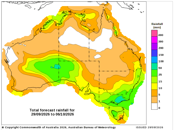
Rainfall outlook map
HAVE YOUR SAY