
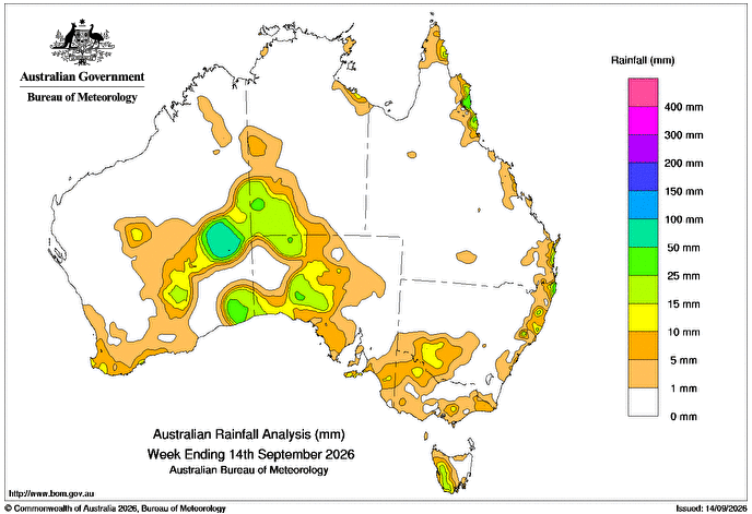
A LOW pressure system supported by a slow-moving upper trough, and the associated surface troughs, brought rainfall to inland and southern parts of Western Australia, south-western Northern Territory and much of South Australia between 8 and 10 September.
 Weekly rainfall totals greater than 15mm were recorded across parts of inland and south-eastern WA extending into south-western NT, and areas in western SA.
Falls greater than 50mm were recorded in parts of WA’s Southern Interior district.
On 12-13 September, a cold front and the associated trough moved across parts of southern Australia generating light to moderate rainfall.
Weekly rainfall totals of 10-25mm were recorded in small areas in the far south-west of WA, north-western Victoria and adjacent parts of New South Wales, and much of western Tasmania.
Throughout the week, a high-pressure system directed moist onshore flow to the east coast of Australia.
Weekly rainfall totals of 10-50mm were recorded in small areas of coastal Queensland and northern NSW.
The highest weekly total at a Bureau of Meteorology gauge was 58mm at Warburton Airfield in WA, including the highest daily total of 40mm in the 24 hours to 9am on 9 September.
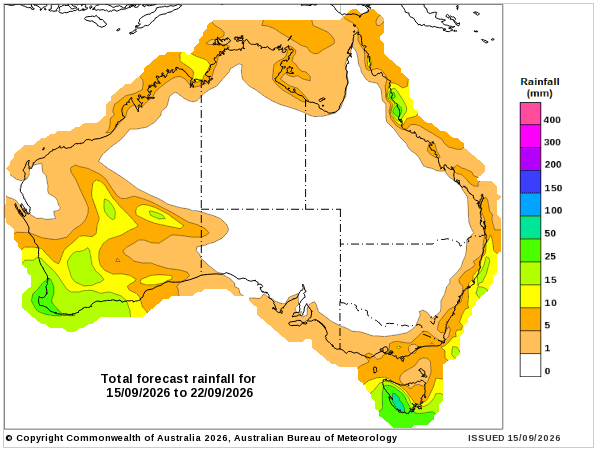
Rainfall outlook map
HAVE YOUR SAY