
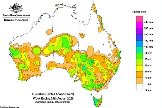
A SERIES of cold fronts across the south and troughs through inland Australia, brought humid air leading to isolated thunderstorms, widespread rain, and showers across the country toward the south-east.
Weekly rainfall totals of 15-100mm were recorded across parts of southern Western Australia and much of the south-east.
Weekly rainfall totals of 10-50mm extended from the west of the Northern Territory and northern South Australia, across south-western Queensland and through inland New South Wales.
Moist onshore winds earlier in the week brought scattered showers to parts of the eastern mainland coast.
Weekly rainfall totals of 15-50mm, and locally higher, were recorded across coastal parts of Northern tropical and central Queensland, and parts of the New South Wales coast.
The highest weekly total at a Bureau of Meteorology gauge was 107.6mm at Sunshine Coast Airport in Queensland, which included the highest daily total of 73.8mm in the 24 hours to 9am on 19 August.
Rainfall outlook
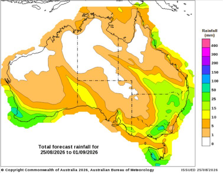
September to November outlook
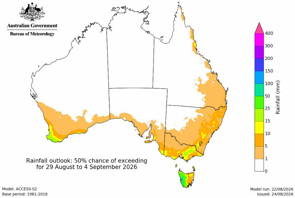
The Bureau of Meteorology is forecasting below average September to November rainfall across parts of the south and east, and above average falls in the west.
September to November rainfall is likely to be below average (60percent to greater than 80pc chance) for the far south-west of Western Australia, south-eastern Australia including Tasmania, and parts of eastern and northern Queensland.
There is an increased chance of unusually low rainfall (50 to 70pc chance) for parts of south-eastern Australia, including regions that have already experienced long-term rainfall deficiencies over the past two years.
Above average rainfall is likely (60pc to greater than 80pc chance) over most of Western Australia extending into the Northern Territory, and western parts of South Australia and Queensland. During this outlook period, northern Australia transitions from the dry to the wet season, bringing increased humidity, storms, and showers.
There is an increased chance of unusually high rainfall (50 to 80pc chance) across much of northern and central parts of Western Australia extending into parts of the western Northern Territory.
The dry signal is strongest early in the season, extending across much of Australia in September, before the wet signal emerges from October. South-western Western Australia and south-eastern Queensland reflect this seasonal shift in the forecast, while southern Victoria and Tasmania remain drier than average forecast throughout the season.
The ACCESS-S rainfall forecast is consistent with international guidance, although there is some variation between models in the likelihood of above-average and below-average rainfall.
Source – Bureau of Meteorology.
HAVE YOUR SAY