
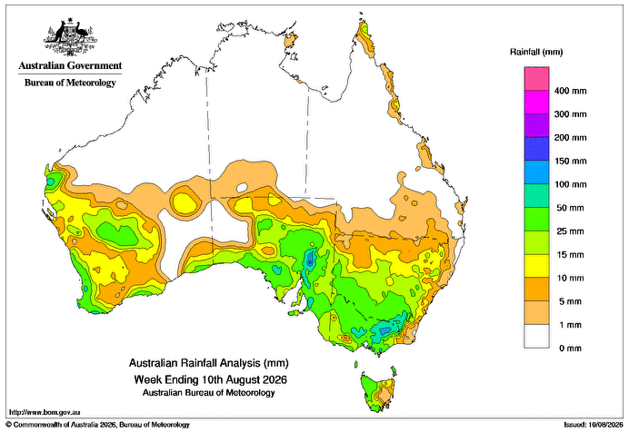
A TROUGH near the Pilbara coastline in Western Australian moved slowly inland from August 4, producing totals of 10mm to more than 50mm near the coast.
A series of low-pressure troughs and cold fronts brought rainfall across parts of southern Australia during the week.
Between August 8 and 10 August, a strong cold front supported by an upper level trough moved across southern Australia, bringing widespread rainfall and triggering flood warnings in Victoria.
Weekly rainfall totals greater than 10mm were recorded across much of southern Australia, including 15-50mm across southern parts of Western Australia, large parts of South Australia, western Tasmania, Victoria and most of New South Wales.
Falls greater than 50mm were recorded across central and north-eastern Victoria extending into south-eastern NSW, and falls greater than 100mm were recorded in the Flinders Ranges in South Australia and in north-eastern Victoria.
The highest weekly total at a Bureau of Meteorology gauge of 178mm was recorded at Myrhee, Hancocks, Victoria, including also the highest daily total of 159mm in the 24 hours to 9am on 10 August.
HAVE YOUR SAY