


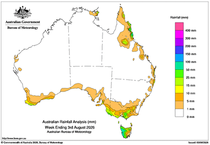
A SERIES of cold fronts and low-pressure troughs brought showers and isolated thunderstorms to far southern Australia, with snow in elevated regions.
Weekly rainfall totals of up to 50mm were recorded in far south-eastern South Australia, southern and north-eastern Victoria, far south-western Western Australia, and northern Tasmania, with higher totals of 50-100mm over western Tasmania.
Persistent high-pressure systems over the south generated light onshore showers along parts of the east coast for most of the week.
Weekly totals up to 25mm were recorded in parts of New South Wales and the Queensland east coast, with higher totals up to 100mm along the tropical coast in Qld.
The highest weekly total at a Bureau of Meteorology gauge of 95mm was recorded at Mt Sophia in Queensland.
The highest daily total at a bureau gauge of 74mm was recorded at Corsis Alert in Queensland in the 24 hours to 9am on 2 August, which is the second-highest daily total for August at this station.
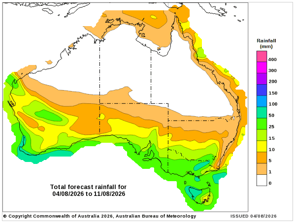
Rainfall outlook map
HAVE YOUR SAY