
SEVERE Tropical Cyclone Narelle made landfall north of Coen, Queensland on March 20 as a Category 4 system.
The cyclone crossed the Cape York Peninsula, Queensland and the Gulf of Carpentaria before making a second landfall near Cape Shield in the Northern Territory on 22 March as a category 3 system.
 As of 1044 CST on 23 March, Narelle has weakened below tropical cyclone strength and is currently positioned over the western Top End of the NT.
Additionally, tropical moisture convergence along the northern Queensland coast led to heavy rainfall.
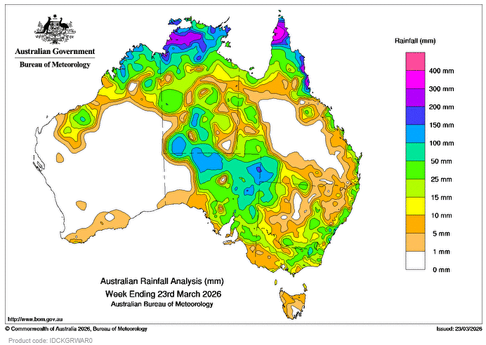
Weekly rainfall totals of 100-300mm, and locally higher, were recorded across parts of the Cape York Peninsula and the north-eastern coast of Queensland, the Top End of the NT and northern parts of the Kimberley, Western Australia.
Earlier this week, a weakening tropical low in the NT brought moisture southwards and interacted with a trough and cold front over southern Australia that brought widespread rain and thunderstorms to much of the NT and South Australia and parts of south-eastern Australia.
Weekly rainfall totals of 25-150mm, and locally higher, were recorded across large parts of the NT, most of northern and eastern South Australia, northern and eastern parts of Victoria and eastern New South Wales.
There is ongoing minor to major flooding across much of Queensland and the Top End of the NT.
The highest weekly total at a Bureau of Meteorology gauge was 466mm at Scherger RAAF in Qld.
The highest daily total at a bureau gauge was 226mm at Weipa Aero in Queensland in the 24 hours to 9am on 21 March.
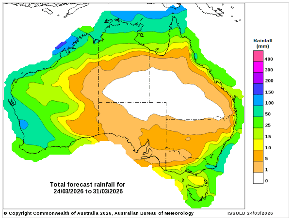
Rainfall outlook map
HAVE YOUR SAY