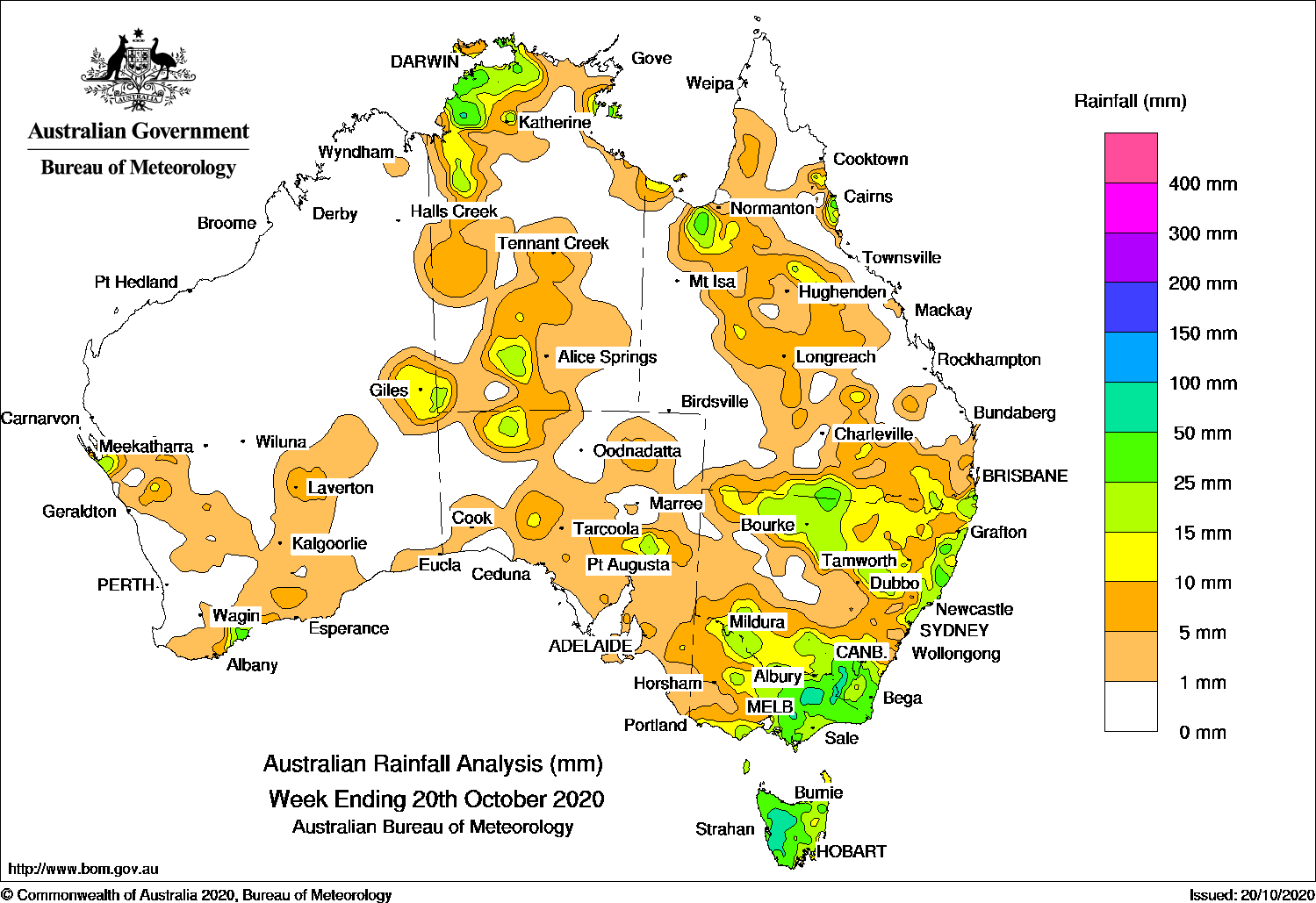
THUNDERSTORMS were reported in Western Australia, the Northern Territory and Queensland, while a trough and cold front produced moderate falls in eastern parts of Australia.
Past seven days: In the first part of the week, a surface trough triggered thunderstorms and showers across the north-west to southern inland parts of Queensland. Showers developed across parts of the coastal Top End in the Northern Territory and on the north tropical coast of Queensland from moist onshore flow. In the west, a trough produced light showers along the south coast of Western Australia.
The trough and associated cloud band extended from south-east Western Australia to South Australia and south-eastern Australia. A cold front behind the trough tracked across Tasmania and southern Victoria and produced moderate falls in western Tasmania, and across southern central, northern and much of eastern Victoria.
By the middle of the week, the trough in eastern South Australia moved east through Victoria and New South Wales, and a weak low pressure system tracked across Bass Strait. Further moderate falls were reported across southern, central and north-west New South Wales, and Tasmania. Widespread light falls were recorded over southern and eastern South Australia, remaining areas of Victoria, and western to central New South Wales.
A surface trough generated thunderstorms and showers over the Top End and central to southern parts of the Northern Territory.
In the last part of the week, the trough and cold front have moved over north-east New South Wales, generating widespread moderate falls over southern to south-east Queensland and north-eastern New South Wales. An inland surface trough extended from south-west Western Australia and central parts of the Northern Territory, and extended further east into central parts of Queensland. Unstable conditions near and to the south of the trough produced thunderstorms in southern inland and eastern Western Australia, and in north-west and southern parts of the Northern Territory.
Rainfall totals exceeding 100 mm were recorded in isolated spots in Victoria’s alpine region, including the highest weekly total of 119 mm at Falls Creek (Rocky Valley).
Rainfall totals exceeding 50 mm were recorded in western Tasmania, north-eastern Victoria and the Snowy Mountains in New South Wales, isolated spots in the north tropical coast of Queensland and in the Darwin–Daly region in the Northern Territory.
Rainfall totals between 10 mm and 50 mm were recorded in parts of the west and south coasts, and eastern Western Australia; in the north-west and southern areas of the Northern Territory and in areas of the pastoral districts in South Australia. Similar totals were reported across most of Tasmania; most of Victoria except in the west; southern, northern and eastern parts of New South Wales, and in southern central and northern Queensland.
Highest weekly totals
New South Wales and Australian Capital Territory
65 mm Wyong (Mount Elliot)
64 mm Thredbo AWS
62 mm Perisher Valley AWS
Victoria
119 mm Falls Creek (Rocky Valley)
116 mm Mount Hotham
110 mm Falls Creek
Queensland
54 mm Babinda Post Office
52 mm Mt Sophia
39 mm Whyanbeel Valley
Western Australia
29 mm Jacup
23 mm Jerramungup
20 mm Tamala
South Australia
28 mm Wilpena Pound
18 mm Parachilna (Motpena)
14 mm Kersbrook
Tasmania
75 mm Mount Read
70 mm Lake Margaret Dam
58 mm Strathgordon Village
Northern Territory
84 mm Karama
80 mm Hayward Creek (Tipperary)
79 mm Kangaroo Flats (Defence)
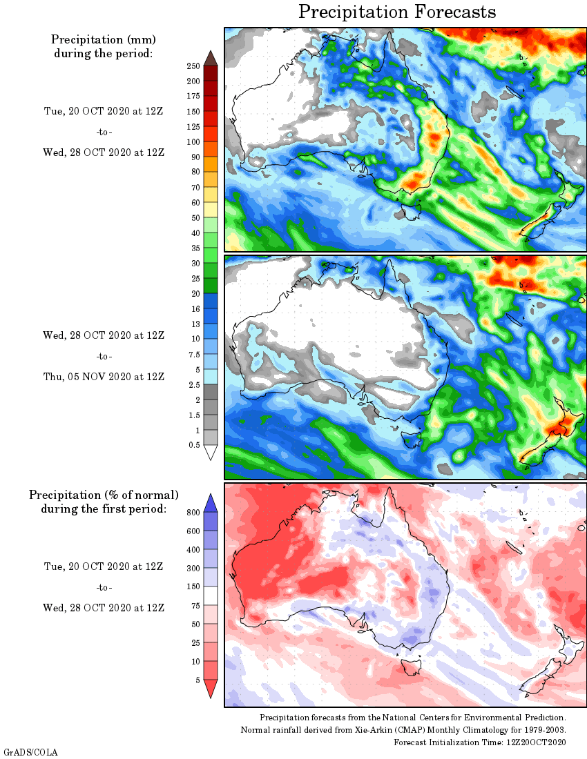
Rainfall outlook


HAVE YOUR SAY