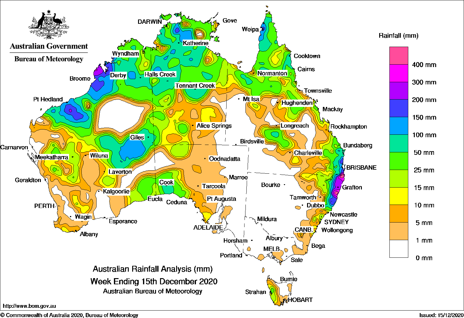
Past seven days: At the start of the week, a cold front embedded in a westerly flow brought moderate falls to western Tasmania.
To the Australian north-west, at the start of the week, a monsoon trough extended from a tropical low near the Kimberley coast to another low to the south of Indonesia. The first tropical low crossed the far south-west Kimberley coast, and generated extensive areas of cloud and thunderstorms, and moderate to heavy falls over northern and interior Western Australia, and the Northern Territory. The second tropical low moved south-east and crossed the Pilbara coast a couple days later. The weakening low moved slowly south over the interior of Western Australia before dissipating in the state’s far south-east. The system and associated cloudband produced showers and thunderstorms with moderate falls across large parts of northern and eastern Western Australia, the north and south of the Northern Territory, and parts of western South Australia at the middle of the week.
In the east, at the start of the week, a surface trough extended from north-west Queensland to the central coast of New South Wales. Thunderstorms and showers developed near the trough, with widespread moderate falls across northern Queensland, and areas of the state’s central west, and in north-eastern to the central coast of New South Wales. A large high pressure system crossed the Great Australian Bight and directed a strong, moist onshore flow with heavy showers and thunderstorms streaming onto south-eastern Queensland and north-eastern New South Wales. A surface- and upper-level trough developed off the south-east Queensland and north-east New South Wales coast and produced moderate to heavy falls, with the heavier falls reported in elevated locations.
At the end of the week, the coastal trough stalled near the south-east Queensland coast, with a low pressure system deepening over Fraser Island. The systems produced further widespread heavy falls over south-east Queensland and north-eastern New South Wales.
In the north, widespread thunderstorms and showers were observed over the northern half of the Northern Territory and the Cape York Peninsula during the week.
Rainfall totals in excess of 400 mm were reported in far south-east Queensland, and in pockets of the Northern Rivers and Mid North Coast districts in New South Wales. The highest weekly total was 680 mm at Springbrook Road in the Gold Coast Hinterland in Queensland. Higher totals were reported by some gauges not within the standard Bureau network, including 953 mm at Upper Springbrook Alert.
Rainfall totals in excess of 200 mm were reported around Cygnet Bay in the west Kimberley coast, and a pocket in the Pilbara of Western Australia, and from south-east Queensland to the Mid North Coast of New South Wales.
Rainfall totals in excess of 100 mm were reported in areas of the western Kimberley and Pilbara in Western Australia, in parts of the Top End in the Northern Territory, areas of the Cape York Peninsula, and the area from south-east Queensland to the Mid North Coast District in New South Wales.
Rainfall totals between 10 mm and 50 mm were reported across large parts of northern, central and south-eastern Western Australia; the western half of South Australia, and most of the northern half and western parts of the Northern Territory. Similar totals were recorded across most of northern, central and eastern Queensland, north-eastern and east coast New South Wales, and western Tasmania.
Highest weekly totals
New South Wales and Australian Capital Territory
547 mm Boat Harbour (Rous River)
522 mm Dorrigo (Old Coramba Rd)Green Pigeon (Morning View)
Victoria
13 mm Springvale Necropolis
9 mm Mount Baw Baw
7 mm Monbulk (Spring Road)
Queensland
680 mm Springbrook Road
295 mm Coolangatta
293 mm Miami Bardon Ave
Western Australia
303 mm Country Downs
246 mm Cygnet Bay
213 mm Derby Main Roads
South Australia
53 mm Cook
24 mm NullarborMaralinga
Tasmania
71 mm Mount Read
43 mm Queenstown (South Queenstown)
29 mm Strathgordon Village
Northern Territory
193 mm Mount Felix
176 mm Mount Bundey South (Defence)
151 mm Fanny Creek
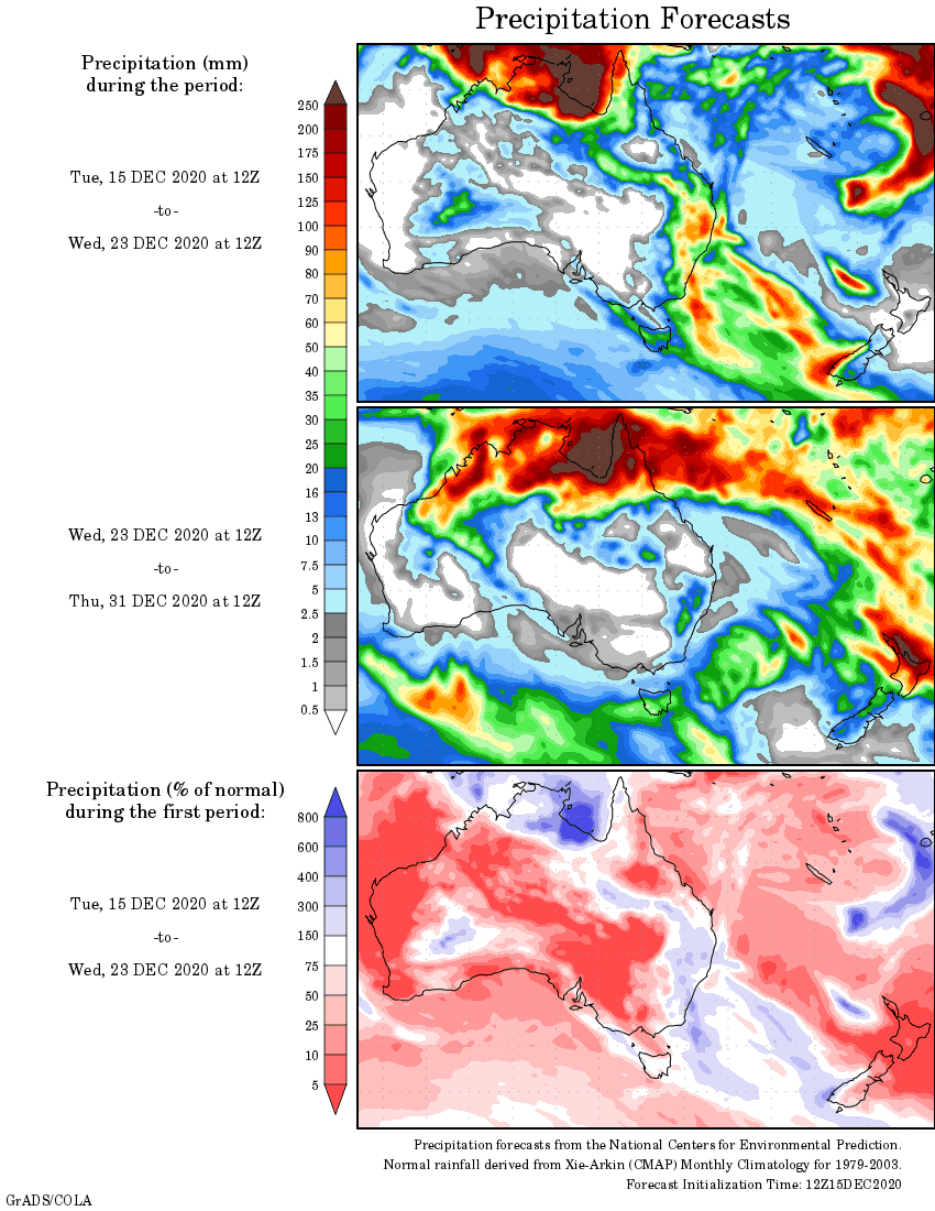
Rainfall outlook


HAVE YOUR SAY