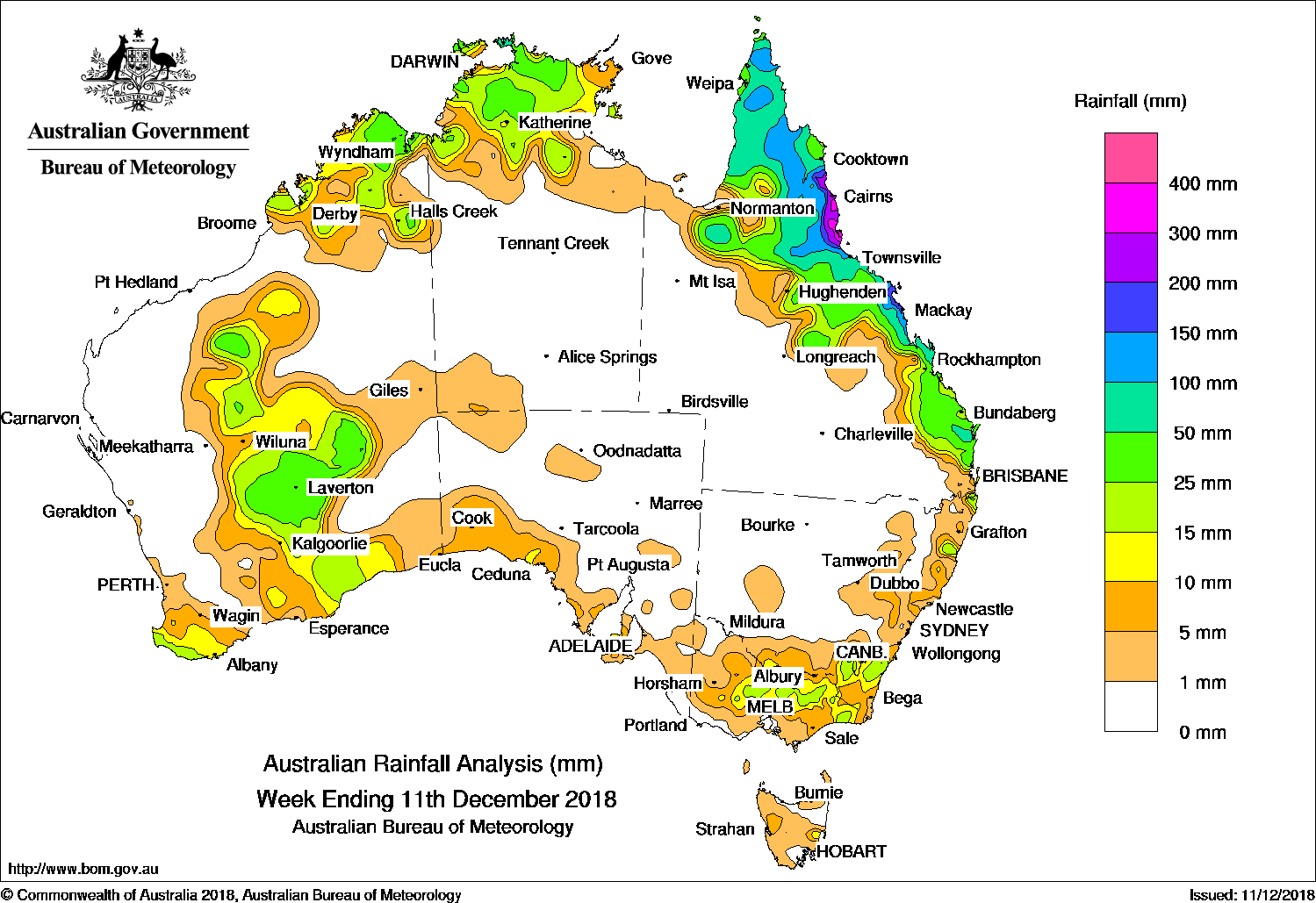
BROAD low pressure troughs produced moderate falls in northern and central Australia, while a deep low pressure system off the New South Wales coast produced locally heavy falls in Sydney, the Illawarra and Central Tablelands districts. The highest weekly total was 222 mm at Faulconbridge in the Central Tablelands of New South Wales.
Past seven days: At the start of the week, showers and thunderstorms brought moderate falls to eastern Queensland and northern Australia due to broad surface troughs in these regions. A cold front and associated cloud band brushed the far southwest of Western Australia, with moderate falls recorded in the area. As the cloud band tracked eastwards, light falls were reported along parts of the southern coasts of Western Australia and South Australia.
A surface trough extending from the Gulf Country to Queensland’s southern interior produced further showers and thunderstorms, with moderate falls in the Cape York Peninsula, northern interior, and north tropical to central coasts of Queensland. Isolated thunderstorms developed about the Top End in the Northern Territory, the Kimberley and parts of inland Western Australia to around the middle of the week.
In the second half of the week, broad surface troughs extended across the north and west, and from the north-west to south-east of Australia. Isolated thunderstorms and showers developed along and near the troughs, with moderate falls recorded in the Top End of the Northern Territory, the Kimberley, and through inland Western Australia. The deepening trough in central Western Australia produced thunderstorms and moderate falls from the Goldfields to southeast Western Australia. Moderate falls were also recorded in northern and north-eastern Victoria and south-east New South Wales.
In the last part of the week, ex-tropical cyclone Owen was embedded on a deep trough off the north coast of Queensland and tracked slowly west south-west. Ex-tropical cyclone Owen crossed around Port Douglas in the north tropical coast early on 10 December, and produced heavy rainfall along the north tropical coast and adjacent inland districts. The tropical low then tracked over the Cape York Peninsula, bringing further heavy falls to parts of the north tropical coast and western areas of the Cape York Peninsula, and moderate falls to remaining parts of far north Queensland.
The highest weekly total was 632 mm at Cardwell Marine Parade in the north tropical Queensland coast. Rainfall totals exceeding 200 mm were recorded around the north tropical Queensland coast, while falls in excess of 100 mm were recorded in areas of the Cape York Peninsula, and north tropical and central coasts of Queensland.
Rainfall totals exceeding 50mm were recorded along parts of Queensland’s east coast and remaining parts of the Cape York Peninsula.
Rainfall totals between 10mm and 50mm were in the Kimberley, eastern Pilbara and Goldfields Districts, as well as south-west and southern parts of Western Australia; the Top End of the Northern Territory; small areas along the southern coast of South Australia; northern and northeast Victoria; south-eastern and parts of the east coast of New South Wales; and eastern and northern Queensland.
Little or no rainfall was recorded in remaining parts of Western Australia; the southern two-thirds of the Northern Territory; western, central and southern Queensland; remaining parts of New South Wales; most of South Australia; north-west and south-west Victoria and most of Tasmania.
Highest weekly totals
New South Wales and Australian Capital Territory
61 mm Mullumbimby (Fairview Farm)
47 mm Parkers Gap
42 mm Murwillumbah (Bray Park)
Victoria
45 mm Combienbar AWS
34 mm Mount Buller
28 mm Merton (Enderlee)Beaufort
Queensland
632 mm Cardwell Marine Pde
410 mm Hawkins Creek
408 mm Cardwell Range
Western Australia
54 mm Wyndham
48 mm Leonora Aero
45 mm Laverton Aero
South Australia
13 mm Auburn
11 mm Ceduna AMO
10 mm multiple locations
Tasmania
45 mm Verwood (Isis River)
25 mm Little Swanport
19 mm Mount Morriston
Northern Territory
64 mmCroker Island Airport
53 mm Geriatric Park
46 mm Mount Stow, Central Waterhouse
More weekly rainfall totals:
- NSW/ACT totals click here
- Vic totals click here
- Qld totals click here
- WA totals click here
- SA totals click here
- Tas totals click here
- NT totals click here
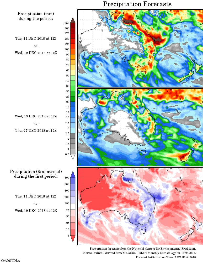
Rainfall outlook:


HAVE YOUR SAY