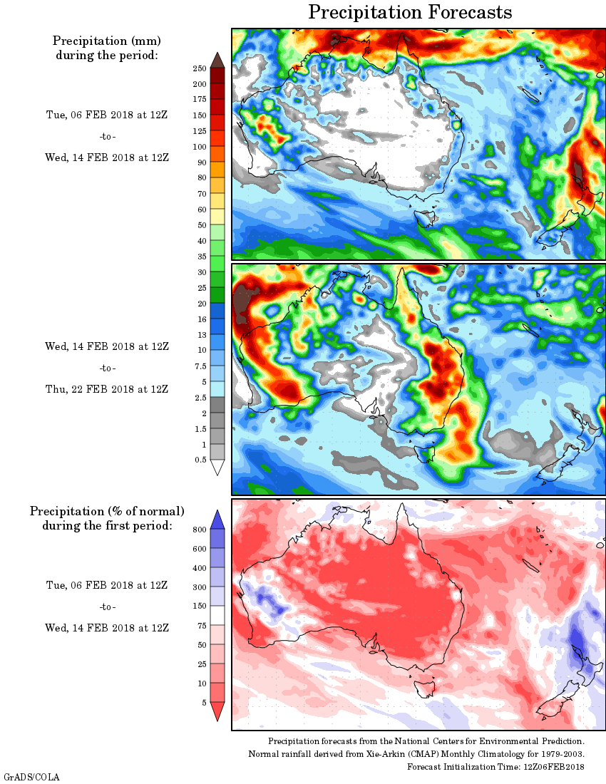
For today’s 14-day rainfall outlook – scroll to bottom of article
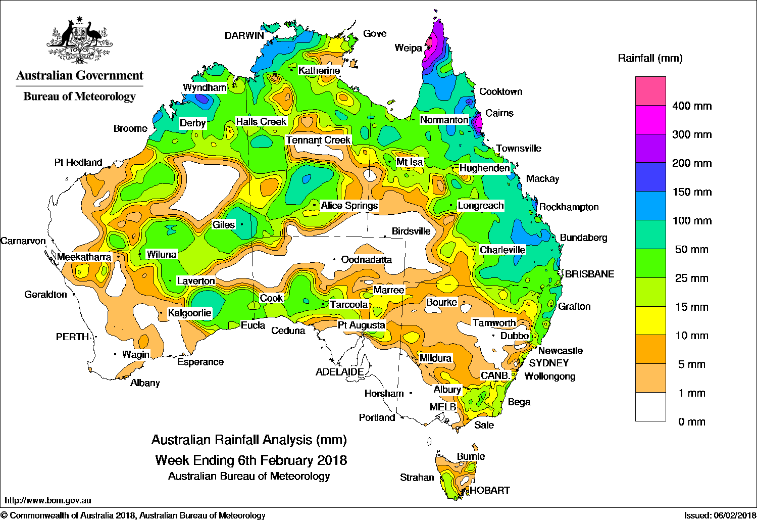
A monsoon trough brought continued heavy rain over the Cape York Peninsula. Moderate falls recorded from showers associated with surface and upper level troughs over the north, eastern Queensland, and parts of central and southern Australia.
Past seven days: The monsoon trough brought heavy rainfall across the Cape York Peninsula following on from heavy rainfall during the previous week. While the trough persisted over the Peninsula and Coral Sea, showers decreased throughout the week. Moderate falls also continued at the start of the week across the northwest of the Northern Territory and in the Kimberley in Western Australia, despite an easing of the monsoon in these areas.
In the south, showers were observed over parts of the Interior and southeast of Western Australia, Central Australia, and parts of South Australia between the west coast and New South Wales border at the start of the week, aided by a strong subsidence inversion created by a large high pressure system south of the Bight trapping a substantial amount of low cloud. Meanwhile a front and accompanying troughs clearing the southeast saw showers over southeastern New South Wales, eastern Victoria, and western Tasmania.
During the middle of the week widespread rainfall was recorded over southeastern Queensland, extending into northwestern Queensland and northeastern New South Wales. Showers were embedded in extensive cloud cover along a surface trough traversing the continent, assisted by south to southeasterly flow associated with a high over the Bight, and an upper level trough which aided convection.
Shower activity migrated to the east coast of Queensland as the surface trough shifted north, with showers and thunderstorms contracting to the coastline of northern Australia during the last two days of the week. An upper level trough over Queensland also contributed to extensive cloud cover over the State, and some heavy rainfall about the northeast tropical coast.
The large high over the Bight was slow to progress, keeping the south of Australia generally dry during the second half of the week.
Rainfall totals in excess of 300 mm were observed on the west coast of the northern Cape York Peninsula and in a small area around Innisfail on east coast. Individual locations within these areas recorded totals of more than 400 mm. The highest weekly total was 507 mm at Aurukun Shire Council, south of Weipa on the west coast of the Cape York Peninsula.
Rainfall totals exceeding 100 mm were observed in parts of the coastal Kimberley in Western Australia, the western to central coast of the Top End in the Northern Territory, across large parts of the northern and eastern Cape York Peninsula surrounding areas of higher falls, in an area of eastern Queensland in the Wide Bay and Burnet region, and other isolated locations in coastal Queensland.
Rainfall totals between 50 mm and 100 mm were recorded across the remainder of eastern Queensland, large parts of the coast of the Top End and Kimberley surrounding areas of higher falls, and in pockets of Central Australia and the southeast of Western Australia.
Rainfall totals between 10 mm and 50 mm were recorded across the remainder of the Kimberley in Western Australia, the eastern Pilbara, southern Interior and Eucla districts; across most of the remainder of the Northern Territory; across most of Queensland except the Channel Country where little or no rain fell; in northeastern New South Wales; in southeastern New South Wales and eastern Victoria; in western and northeastern Tasmania; and across South Australia between the West Coast District and the New South Wales border.
Little or no rainfall was recorded across the west of Western Australia and the north of the Interior District; across the north of South Australia and Queensland’s Channel Country; the Eyre Peninsula, southeastern South Australia and most of Victoria away from the east; and parts of New South Wales adjacent to the Central Coast.
Highest weekly totals
New South Wales and Australian Capital Territory
134 mm Careys Peak (Barrington Tops)
124 mm Ballina Airport Aws
116 mm Green Pigeon (Morning View)
Victoria
41 mm Falls Creek (Rocky Valley)
36 mm Falls Creek
28 mm Mallacoota
Queensland
507 mm Aurukun Shire Council
451 mm Scherger Raaf
447 mm Russell River
Western Australia
197 mm Mount Elizabeth
119 mm Country Downs
111 mm Mount Barnett
South Australia
39 mm Bruce
36 mm Carrieton
31 mm Orroroo
Tasmania
53 mm Hummocky Hills
47 mm Pyengana (Forest Lodge Road)
30 mm Mount Victoria (Una Plain)
Northern Territory
211 mm Walker Creek
206 mm Mount Bundey North (Defence)
173 mm Labelle Downs
More weekly rainfall totals:
- NSW/ACT totals click here
- Vic totals click here
- Qld totals click here
- WA totals click here
- SA totals click here
- Tas totals click here
- NT totals click here
Source: BOM


HAVE YOUR SAY