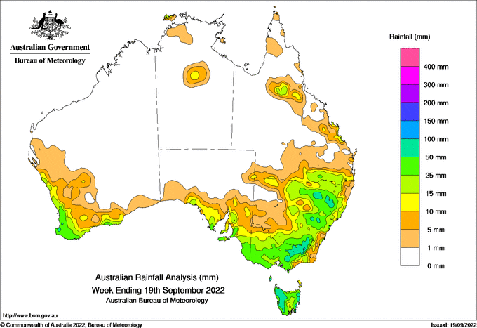
A STRONG cold front embedded with storms crossed southern Western Australia on the 13th with 30–60 mm totals observed around Bussellton.
The front continued over south-east Australia on the 15th, connecting with a complex low south of the Great Australian Bight, bringing significant falls west of the ranges in northern New South Wales and the Queensland border region, including some daily records for September.
Weekly totals of 25–100 mm resulted in increased flooding in catchments on the western slopes of the Great Dividing Range and some inland areas of New South Wales, and caused minor flooding in some catchments around Melbourne and north-east Tasmania.
Weekly totals of 1–25 mm fell further inland, along the southern coast, in northern South Australia and into central Queensland and around Darwin.
Alpine regions had daily totals of 10–50 mm at the end of the week, much of it falling as snow in Victoria.
The highest weekly total (at a Bureau gauge) was 152.8 mm at Perisher Valley.
The highest daily total (at a Bureau gauge) was 77.4 mm at Barraba (Mount Lindsay) to 9 am on the 16th.


HAVE YOUR SAY