Oct-Dec 2019 rainfall outlook:
Drier than average likely, but may start to ease in summer
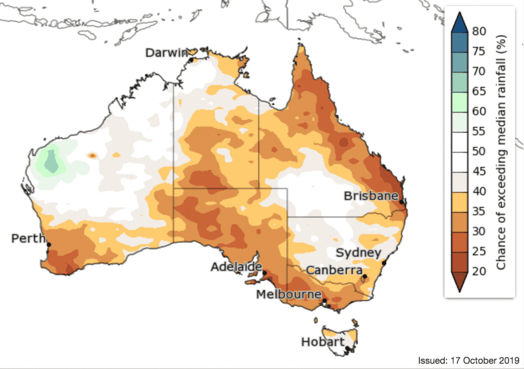
RAINFALL is likely to be below average for most of the country for the remainder of October and November.
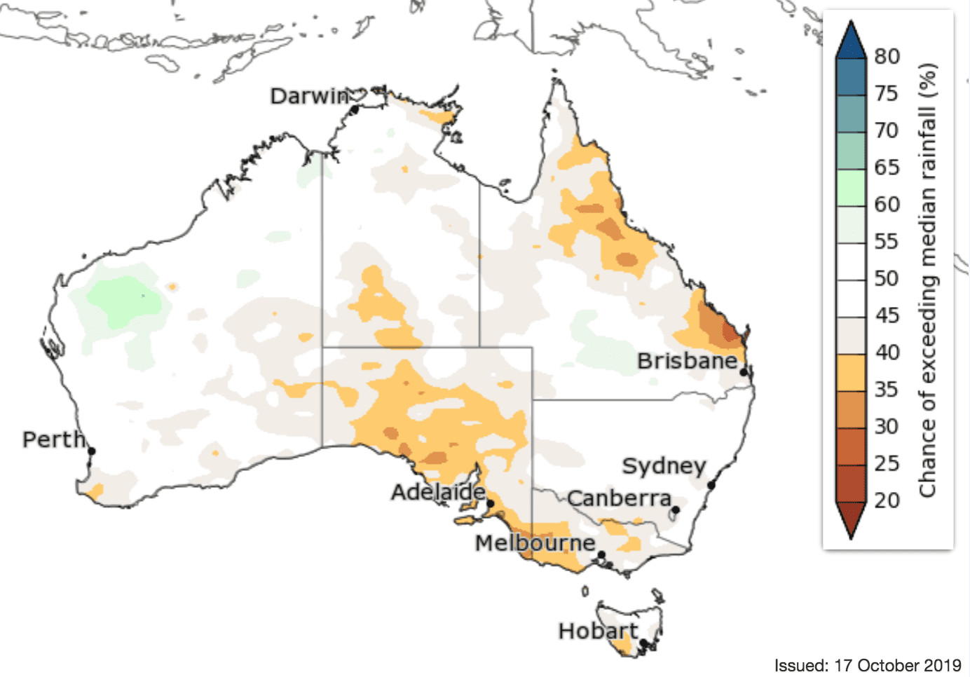
However, north-west Western Australia has roughly equal chances of being wetter or drier across most outlook periods, with a slightly increased chance of being wetter than average in December.
The drier outlook continues into December for southern Australia, eastern Queensland, far north-east New South Wales and much of the Northern Territory, with the remainder of the country having roughly equal chances of being wetter or drier than average.
While the outlooks for drier than average conditions ease in the coming months, it should be noted that this won’t necessarily ease the current rainfall deficiencies. Several months of above average rainfall would be needed to see a recovery from current conditions.
December to February rainfall outlook:
Above average temperatures forecast to continue
Daytime temperatures are likely to be warmer than average across Australia for the remainder of 2019 and early 2020. For November to January, most of Australia has a greater than 80 percent chance of warmer than average days.
Nights are likely to be warmer than average for November in WA, the western NT, southern and western Queensland and eastern NSW. Elsewhere, chances of warmer or cooler nights are roughly equal.
December to February nights are likely to be warmer nationwide.
Source: Bureau of Meteorology. To view more outlook maps for coming weeks and months click here
Comparison – previous forecast versus actual rainfall
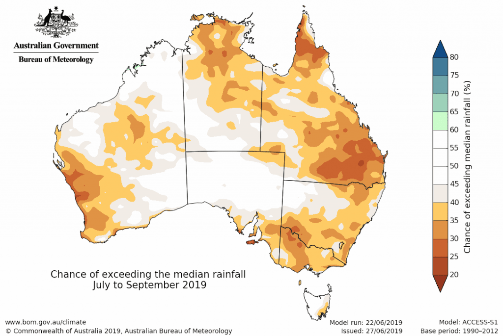
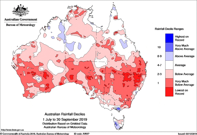
Maps below compare BOM’s rainfall forecast for March to May 2019, issued in February 2019, with actual rainfall deciles recorded over the May to July 2019 period.
FORECAST MEDIAN RAINFALL JULY to SEPT 2019:
RAINFALL DECILES RECORDED JULY to SEP 2019:
Source: Bureau of Meteorology


HAVE YOUR SAY